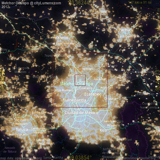
Melchor Ocampo night lights from space
Night Light of Melchor Ocampo (México) from space (Mexico) Src. Average luminocity for 10x10km area is 92.969% and for 50x50km: 71.3696%.
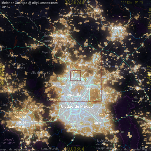
Analysis of Melchor Ocampo night lights 2016
Square area 10x10 km:
 36.78%
90-99
33.88%80-89
14.46%70-79
14.05%60-69
0.83%50-59
0%40-49
0%30-39
0%20-29
0%10-19
0%0-9
0%Square area 50x50 km:
23.23%90-99
13.25%80-89
11.62%70-79
12.19%60-69
10.9%50-59
6%40-49
4.83%30-39
4.69%20-29
5.89%10-19
4.67%0-9
2.73%Clear (daylight) street map image can be seen on geolist.org.
Map coordinates:
20° 21' 44.8" North, 99° 50' 52.7" West
19° 42' 6.7" North, 99° 8' 41.5" West
19° 2' 18.7" North, 98° 26' 30.2" West
Some cities around Melchor Ocampo sort by population:
• San Pablo de las Salinas
6.5 km =4 mi,  126°
126°
• Cuautitlán
5.1 km =3.2 mi,  226°
226°
• Tultepec
2.6 km =1.6 mi,  136°
136°
• Santiago Teyahualco
5.1 km =3.2 mi,  155°
155°
• Teoloyucan
6.1 km =3.8 mi,  321°
321°
• Tultitlán de Mariano Escobedo
6.6 km =4.1 mi,  201°
201°
• San Bartolo
3.6 km =2.2 mi,  334°
334°
• San Mateo Ixtacalco
2.8 km =1.7 mi,  263°
263°
3827586 (p: 38,599)
Sources (retrieved 2019-11-25):
» Earth at Night: Flat Maps 2012, 2016