Temixco night lights from space
Night Light of Temixco (Morelos) from space (Mexico) Src. Average luminocity for 10x10km area is 82.3009% and for 50x50km: 29.4179%.
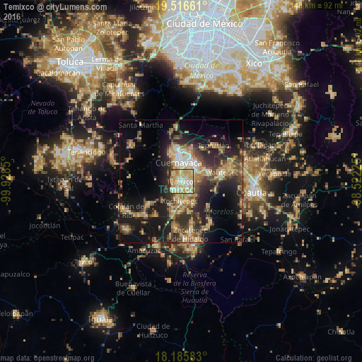
Analysis of Temixco night lights 2016
Square area 10x10 km:
 9.31%
9.31%90-99
24.03%80-89
33.12%70-79
19.7%60-69
6.06%50-59
2.16%40-49
4.11%30-39
1.08%20-29
0.43%10-19
0%0-9
0%Square area 50x50 km:
1.37%90-99
3.09%80-89
6.12%70-79
5.53%60-69
5.08%50-59
3.33%40-49
6.52%30-39
5.09%20-29
9.65%10-19
17.65%0-9
36.57%Clear (daylight) street map image can be seen on geolist.org.
Map coordinates:
19° 30' 59.8" North, 99° 55' 42.6" West
18° 51' 9.1" North, 99° 13' 31.3" West
18° 11' 9" North, 98° 31' 20.1" West
Some cities around Temixco sort by population:
• Jiutepec
5.9 km =3.7 mi,  57°
57°
• Emiliano Zapata
4.5 km =2.8 mi,  107°
107°
• Xochitepec
8 km =5 mi,  183°
183°
• Tres de Mayo
2.5 km =1.6 mi,  45°
45°
• Progreso
8.2 km =5.1 mi,  68°
68°
• Unidad Habitacional José María Morelos y Pavón
5.3 km =3.3 mi,  227°
227°
• Chiconcuac
8 km =5 mi,  166°
166°
• Calera Chica
4.6 km =2.9 mi,  81°
81°
3516035 (p: 97,788)
Sources (retrieved 2019-11-25):
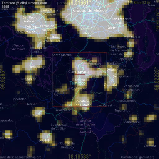
» NASA, Earths city lights 1995
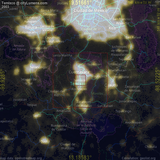
» NASA city lights 2003
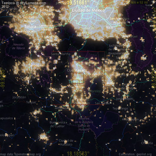
» Earth at Night: Flat Maps 2012, 2016