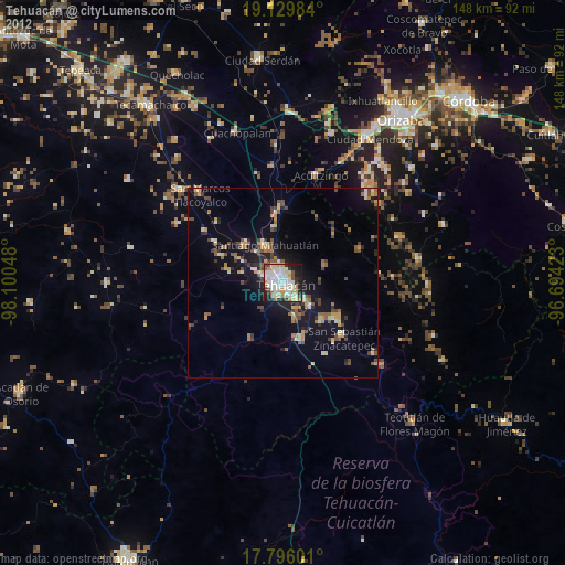
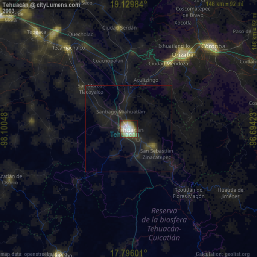
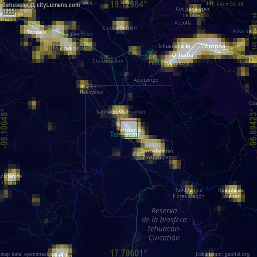
Tehuacán night lights from space
Night Light of Tehuacán (Puebla) from space (Mexico) Src. Average luminocity for 10x10km area is 72.1715% and for 50x50km: 10.1997%.
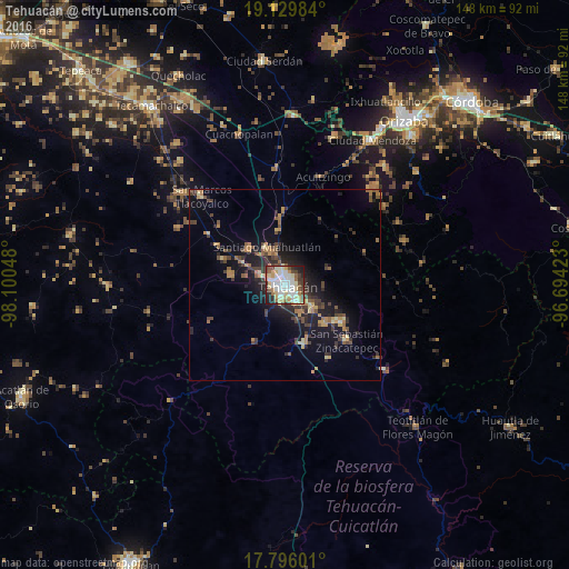
Analysis of Tehuacán night lights 2016
Square area 10x10 km:
 18.6%
18.6%90-99
20.25%80-89
15.7%70-79
7.23%60-69
4.96%50-59
6.2%40-49
8.68%30-39
5.58%20-29
9.92%10-19
2.89%0-9
0%Square area 50x50 km:
0.75%90-99
0.84%80-89
1.45%70-79
1.36%60-69
1.69%50-59
1.41%40-49
2.11%30-39
2.14%20-29
3.18%10-19
7.5%0-9
77.56%Clear (daylight) street map image can be seen on geolist.org.
Map coordinates:
19° 7' 47.4" North, 98° 6' 1.7" West
18° 27' 51.2" North, 97° 23' 50.5" West
17° 47' 45.6" North, 96° 41' 39.2" West
Some cities around Tehuacán sort by population:
• Ajalpan
17.4 km =10.8 mi,  122°
122°
• Altepexi
14.7 km =9.1 mi,  135°
135°
• Zinacatepec
21.5 km =13.4 mi,  131°
131°
• Miahuatlán
10.5 km =6.5 mi,  334°
334°
• San Gabriel Chilac
16.3 km =10.1 mi,  160°
160°
• Magdalena Cuayucatepec
13.2 km =8.2 mi,  315°
315°
• Teontepec
14.3 km =8.9 mi,  282°
282°
• Chapulco
18 km =11.2 mi,  357°
357°
3516109 (p: 248,716)
Sources (retrieved 2019-11-25):
» NASA, Earths city lights 1995
» NASA city lights 2003
» Earth at Night: Flat Maps 2012, 2016