Teontepec night lights from space
Night Light of Teontepec (Puebla) from space (Mexico) Src. Average luminocity for 10x10km area is 15.7955% and for 50x50km: 9.7876%.
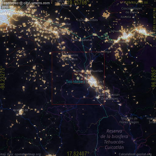
Analysis of Teontepec night lights 2016
Square area 10x10 km:
 0%
0%90-99
0%80-89
1.65%70-79
1.24%60-69
5.79%50-59
3.1%40-49
3.31%30-39
3.31%20-29
3.51%10-19
18.8%0-9
59.3%Square area 50x50 km:
0.73%90-99
0.81%80-89
1.28%70-79
1.15%60-69
1.72%50-59
1.32%40-49
2.29%30-39
2.33%20-29
3.02%10-19
7.1%0-9
78.23%Clear (daylight) street map image can be seen on geolist.org.
Map coordinates:
19° 9' 27.6" North, 98° 13' 57.9" West
18° 29' 31.8" North, 97° 31' 46.6" West
17° 49' 26.7" North, 96° 49' 35.4" West
Some cities around Teontepec sort by population:
• Tehuacán
14.3 km =8.9 mi,  102°
102°
• Miahuatlán
11.5 km =7.1 mi,  55°
55°
• San Gabriel Chilac
26.7 km =16.6 mi,  133°
133°
• San Marcos Tlacoyalco
21.7 km =13.5 mi,  338°
338°
• Magdalena Cuayucatepec
8 km =5 mi,  36°
36°
• Tlacotepec
25 km =15.5 mi,  327°
327°
• Santa María la Alta
18.1 km =11.2 mi,  311°
311°
• Chapulco
19.9 km =12.4 mi, 41°
3519632 (p: 5,593)
Sources (retrieved 2019-11-25):
» Earth at Night: Flat Maps 2012, 2016