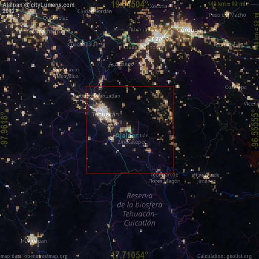
Ajalpan night lights from space
Night Light of Ajalpan (Puebla) from space (Mexico) Src. Average luminocity for 10x10km area is 25.2211% and for 50x50km: 8.9421%.
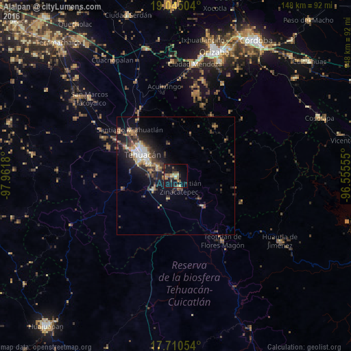
Analysis of Ajalpan night lights 2016
Square area 10x10 km:
 0.41%
0.41%90-99
0.83%80-89
3.93%70-79
5.17%60-69
5.17%50-59
4.13%40-49
5.17%30-39
2.48%20-29
6.82%10-19
32.64%0-9
33.26%Square area 50x50 km:
0.75%90-99
0.87%80-89
1.31%70-79
1.17%60-69
1.2%50-59
1.08%40-49
1.97%30-39
2.1%20-29
2.96%10-19
6.88%0-9
79.71%Clear (daylight) street map image can be seen on geolist.org.
Map coordinates:
19° 2' 42.1" North, 97° 57' 42.5" West
18° 22' 44.7" North, 97° 15' 31.2" West
17° 42' 37.9" North, 96° 33' 20" West
Some cities around Ajalpan sort by population:
• Tehuacán
17.4 km =10.8 mi,  302°
302°
• Altepexi
4.4 km =2.7 mi,  257°
257°
• Zinacatepec
5.1 km =3.2 mi,  164°
164°
• Miahuatlán
26.9 km =16.7 mi,  314°
314°
• San Gabriel Chilac
11 km =6.8 mi,  237°
237°
• Magdalena Cuayucatepec
30.5 km =19 mi, 308°
• Miahuatlán
10.2 km =6.3 mi,  197°
197°
• Coxcatlán
16.9 km =10.5 mi,  137°
137°
3533126 (p: 28,031)
Sources (retrieved 2019-11-25):
» Earth at Night: Flat Maps 2012, 2016