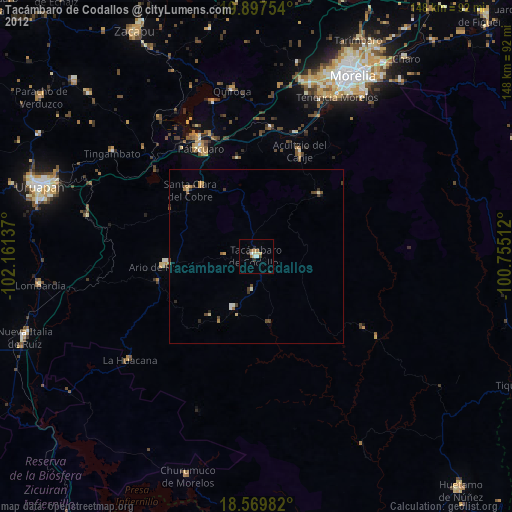
Tacámbaro de Codallos night lights from space
Night Light of Tacámbaro de Codallos (Michoacán) from space (Mexico) Src. Average luminocity for 10x10km area is 8.3052% and for 50x50km: 1.1998%.
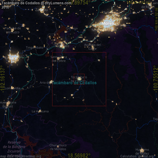
Analysis of Tacámbaro de Codallos night lights 2016
Square area 10x10 km:
 0%
0%90-99
0.65%80-89
3.68%70-79
2.6%60-69
0%50-59
0%40-49
1.73%30-39
0%20-29
1.73%10-19
0%0-9
89.61%Square area 50x50 km:
0%90-99
0.06%80-89
0.39%70-79
0.19%60-69
0.19%50-59
0.04%40-49
0.22%30-39
0.19%20-29
0.43%10-19
0.06%0-9
98.23%Clear (daylight) street map image can be seen on geolist.org.
Map coordinates:
19° 53' 51.1" North, 102° 9' 40.9" West
19° 14' 6.1" North, 101° 27' 29.7" West
18° 34' 11.4" North, 100° 45' 18.4" West
Some cities around Tacámbaro de Codallos sort by population:
• Pátzcuaro
35 km =21.7 mi,  333°
333°
• Ario de Rosales
26.3 km =16.3 mi,  263°
263°
• Santa Clara del Cobre
26.9 km =16.7 mi,  314°
314°
• Opopeo
25 km =15.5 mi,  321°
321°
• Puruarán
16.8 km =10.4 mi,  203°
203°
• Acuítzio del Canje
31.8 km =19.8 mi,  24°
24°
• Villa Madero
25.6 km =15.9 mi,  47°
47°
• Pedernales
10.5 km =6.5 mi,  186°
186°
3982693 (p: 25,665)
Sources (retrieved 2019-11-25):
» Earth at Night: Flat Maps 2012, 2016