Acuítzio del Canje night lights from space
Night Light of Acuítzio del Canje (Michoacán) from space (Mexico) Src. Average luminocity for 10x10km area is 8.1632% and for 50x50km: 9.9442%.
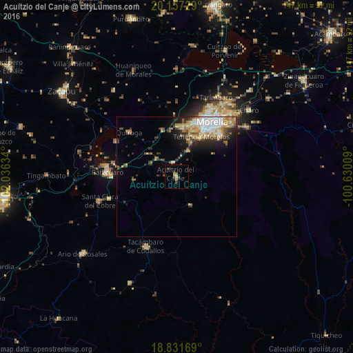
Analysis of Acuítzio del Canje night lights 2016
Square area 10x10 km:
 0%
0%90-99
0.62%80-89
0.41%70-79
1.65%60-69
2.27%50-59
0.21%40-49
3.1%30-39
0.83%20-29
2.07%10-19
2.07%0-9
86.78%Square area 50x50 km:
1.58%90-99
1.67%80-89
1.71%70-79
1.32%60-69
1.59%50-59
0.7%40-49
1.62%30-39
1.32%20-29
2.16%10-19
3.44%0-9
82.89%Clear (daylight) street map image can be seen on geolist.org.
Map coordinates:
20° 9' 26.2" North, 102° 2' 10.8" West
19° 29' 45.1" North, 101° 19' 59.6" West
18° 49' 54.1" North, 100° 37' 48.3" West
Some cities around Acuítzio del Canje sort by population:
• Morelia
27.6 km =17.1 mi,  34°
34°
• Pátzcuaro
29 km =18 mi,  274°
274°
• Quiroga
27.4 km =17 mi,  313°
313°
• Morelos
19.7 km =12.2 mi, 30°
• Conjunto Habitacional Villas del Pedregal
21.1 km =13.1 mi,  8°
8°
• Opopeo
30 km =18.6 mi,  251°
251°
• Villa Madero
12.9 km =8 mi,  153°
153°
• Capula
20.7 km =12.9 mi,  342°
342°
4019757 (p: 6,733)
Sources (retrieved 2019-11-25):
» Earth at Night: Flat Maps 2012, 2016