Sayula night lights from space
Night Light of Sayula (Jalisco) from space (Mexico) Src. Average luminocity for 10x10km area is 11.6667% and for 50x50km: 3.9893%.
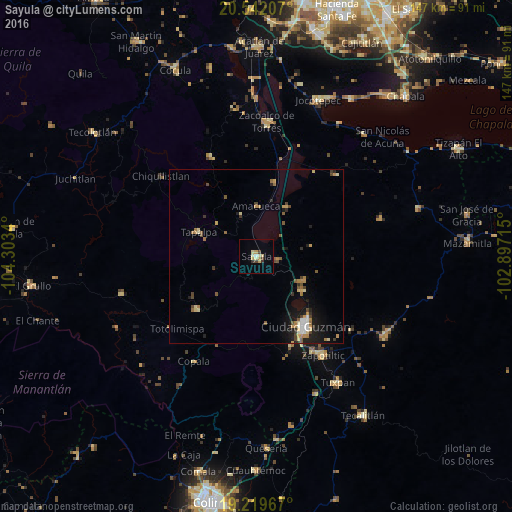
Analysis of Sayula night lights 2016
Square area 10x10 km:
 0.65%
0.65%90-99
1.08%80-89
4.11%70-79
2.16%60-69
0.65%50-59
0%40-49
2.6%30-39
1.73%20-29
0%10-19
0%0-9
87.01%Square area 50x50 km:
0.25%90-99
0.42%80-89
0.66%70-79
0.59%60-69
0.71%50-59
0.57%40-49
0.71%30-39
0.48%20-29
0.56%10-19
2.53%0-9
92.55%Clear (daylight) street map image can be seen on geolist.org.
Map coordinates:
20° 32' 31.5" North, 104° 18' 12.2" West
19° 52' 56.1" North, 103° 36' 1" West
19° 13' 10.8" North, 102° 53' 49.7" West
Some cities around Sayula sort by population:
• Ciudad Guzmán
24.5 km =15.2 mi,  143°
143°
• Zapotiltic
34.2 km =21.3 mi,  145°
145°
• Usmajac
6.3 km =3.9 mi,  97°
97°
• San Sebastián del Sur
16.5 km =10.3 mi,  126°
126°
• Tapalpa
18.1 km =11.2 mi,  292°
292°
• Atemajac de Brizuela
31.3 km =19.4 mi,  335°
335°
• San Andrés Ixtlán
15.4 km =9.6 mi,  116°
116°
• Atoyac
16.7 km =10.4 mi,  31°
31°
3983216 (p: 26,789)
Sources (retrieved 2019-11-25):
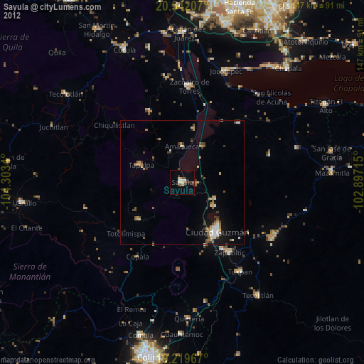
» Earth at Night: Flat Maps 2012, 2016