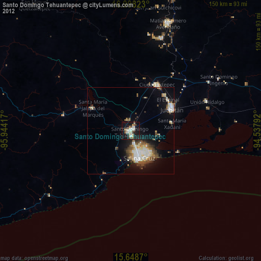
Santo Domingo Tehuantepec night lights from space
Night Light of Santo Domingo Tehuantepec (Oaxaca) from space (Mexico) Src. Average luminocity for 10x10km area is 36.0475% and for 50x50km: 12.121%.
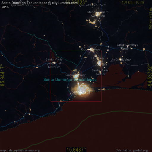
Analysis of Santo Domingo Tehuantepec night lights 2016
Square area 10x10 km:
 3.51%
3.51%90-99
8.88%80-89
5.99%70-79
3.93%60-69
1.65%50-59
2.89%40-49
3.31%30-39
7.85%20-29
16.32%10-19
34.3%0-9
11.36%Square area 50x50 km:
1.33%90-99
2.96%80-89
1.66%70-79
1.18%60-69
0.94%50-59
1.54%40-49
1.84%30-39
2.37%20-29
2.94%10-19
7.85%0-9
75.38%Clear (daylight) street map image can be seen on geolist.org.
Map coordinates:
16° 59' 53.6" North, 95° 56' 39" West
16° 19' 28.7" North, 95° 14' 27.7" West
15° 38' 55.3" North, 94° 32' 16.5" West
Some cities around Santo Domingo Tehuantepec sort by population:
• Salina Cruz
17.3 km =10.7 mi,  163°
163°
• Juchitán de Zaragoza
26.7 km =16.6 mi,  62°
62°
• Ixtepec
30 km =18.6 mi,  29°
29°
• San Blas Atempa
1.8 km =1.1 mi,  66°
66°
• Santa María Jalapa del Marqués
25.2 km =15.7 mi,  300°
300°
• El Espinal
27.9 km =17.3 mi,  50°
50°
• Santa María Xadani
24.1 km =15 mi,  80°
80°
• Asunción Ixtaltepec
27.6 km =17.1 mi,  44°
44°
3516843 (p: 42,082)
Sources (retrieved 2019-11-25):
» Earth at Night: Flat Maps 2012, 2016