Santa María Xadani night lights from space
Night Light of Santa María Xadani (Oaxaca) from space (Mexico) Src. Average luminocity for 10x10km area is 7.2107% and for 50x50km: 12.1753%.
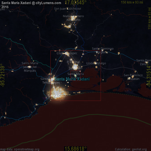
Analysis of Santa María Xadani night lights 2016
Square area 10x10 km:
 0%
0%90-99
1.65%80-89
0%70-79
0.83%60-69
0%50-59
0.83%40-49
0.41%30-39
2.07%20-29
0.41%10-19
11.98%0-9
81.82%Square area 50x50 km:
1.37%90-99
3.19%80-89
1.8%70-79
1.45%60-69
0.99%50-59
1.41%40-49
1.72%30-39
2.17%20-29
2.19%10-19
6.06%0-9
77.64%Clear (daylight) street map image can be seen on geolist.org.
Map coordinates:
17° 2' 7.6" North, 95° 43' 17" West
16° 21' 43.1" North, 95° 1' 5.7" West
15° 41' 10.2" North, 94° 18' 54.5" West
Some cities around Santa María Xadani sort by population:
• Juchitán de Zaragoza
8.2 km =5.1 mi,  358°
358°
• Santo Domingo Tehuantepec
24.1 km =15 mi,  260°
260°
• Ixtepec
23.9 km =14.9 mi,  337°
337°
• Unión Hidalgo
23.6 km =14.7 mi,  58°
58°
• San Blas Atempa
22.4 km =13.9 mi, 261°
• El Espinal
13.9 km =8.6 mi,  350°
350°
• Asunción Ixtaltepec
16.4 km =10.2 mi, 343°
• San Mateo del Mar
17.3 km =10.7 mi,  167°
167°
3514576 (p: 7,613)
Sources (retrieved 2019-11-25):
» Earth at Night: Flat Maps 2012, 2016