Juchitán de Zaragoza night lights from space
Night Light of Juchitán de Zaragoza (Oaxaca) from space (Mexico) Src. Average luminocity for 10x10km area is 35.6612% and for 50x50km: 8.7355%.
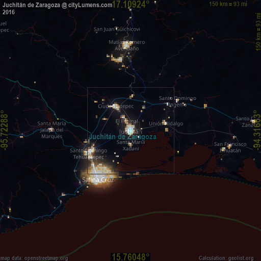
Analysis of Juchitán de Zaragoza night lights 2016
Square area 10x10 km:
 6.4%
6.4%90-99
9.09%80-89
6.61%70-79
2.69%60-69
1.65%50-59
2.89%40-49
1.65%30-39
3.31%20-29
4.13%10-19
46.69%0-9
14.88%Square area 50x50 km:
0.74%90-99
2.12%80-89
1.3%70-79
1.08%60-69
0.66%50-59
0.98%40-49
1.11%30-39
1.63%20-29
1.79%10-19
5.41%0-9
83.18%Clear (daylight) street map image can be seen on geolist.org.
Map coordinates:
17° 6' 33.3" North, 95° 43' 22.4" West
16° 26' 9.7" North, 95° 1' 11.1" West
15° 45' 37.7" North, 94° 18' 59.9" West
Some cities around Juchitán de Zaragoza sort by population:
• Santo Domingo Tehuantepec
26.7 km =16.6 mi,  242°
242°
• Ixtepec
16.5 km =10.3 mi,  327°
327°
• Unión Hidalgo
20.7 km =12.9 mi,  78°
78°
• San Blas Atempa
24.9 km =15.5 mi, 242°
• El Espinal
5.9 km =3.7 mi,  338°
338°
• Santa María Xadani
8.2 km =5.1 mi,  178°
178°
• Asunción Ixtaltepec
8.7 km =5.4 mi, 329°
• San Mateo del Mar
25.4 km =15.8 mi,  170°
170°
3526357 (p: 74,825)
Sources (retrieved 2019-11-25):
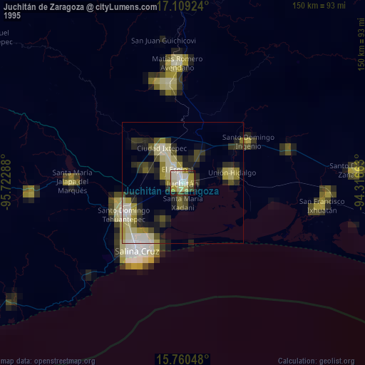
» NASA, Earths city lights 1995
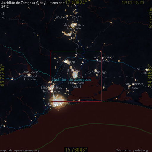
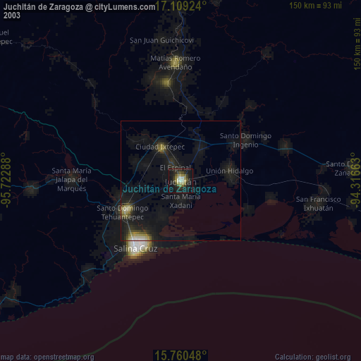
» NASA city lights 2003
» Earth at Night: Flat Maps 2012, 2016