El Espinal night lights from space
Night Light of El Espinal (Oaxaca) from space (Mexico) Src. Average luminocity for 10x10km area is 29.0661% and for 50x50km: 6.3123%.
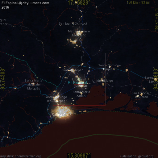
Analysis of El Espinal night lights 2016
Square area 10x10 km:
 3.51%
3.51%90-99
4.75%80-89
7.64%70-79
2.27%60-69
0.83%50-59
4.55%40-49
1.45%30-39
4.55%20-29
3.93%10-19
35.54%0-9
30.99%Square area 50x50 km:
0.44%90-99
1.19%80-89
0.96%70-79
0.69%60-69
0.45%50-59
0.64%40-49
0.74%30-39
1.32%20-29
1.75%10-19
5.45%0-9
86.38%Clear (daylight) street map image can be seen on geolist.org.
Map coordinates:
17° 9' 29.8" North, 95° 44' 35.1" West
16° 29' 6.9" North, 95° 2' 23.8" West
15° 48' 35.5" North, 94° 20' 12.6" West
Some cities around El Espinal sort by population:
• Juchitán de Zaragoza
5.9 km =3.7 mi,  158°
158°
• Santo Domingo Tehuantepec
27.9 km =17.3 mi,  230°
230°
• Ixtepec
10.8 km =6.7 mi,  320°
320°
• Unión Hidalgo
22.5 km =14 mi,  93°
93°
• San Blas Atempa
26.2 km =16.3 mi, 229°
• Santa María Xadani
13.9 km =8.6 mi,  170°
170°
• Asunción Ixtaltepec
3 km =1.9 mi,  311°
311°
• San Mateo del Mar
31.2 km =19.4 mi, 168°
3527737 (p: 7,823)
Sources (retrieved 2019-11-25):
» Earth at Night: Flat Maps 2012, 2016