Santa Teresa night lights from space
Night Light of Santa Teresa (México) from space (Mexico) Src. Average luminocity for 10x10km area is 72.0325% and for 50x50km: 48.0278%.
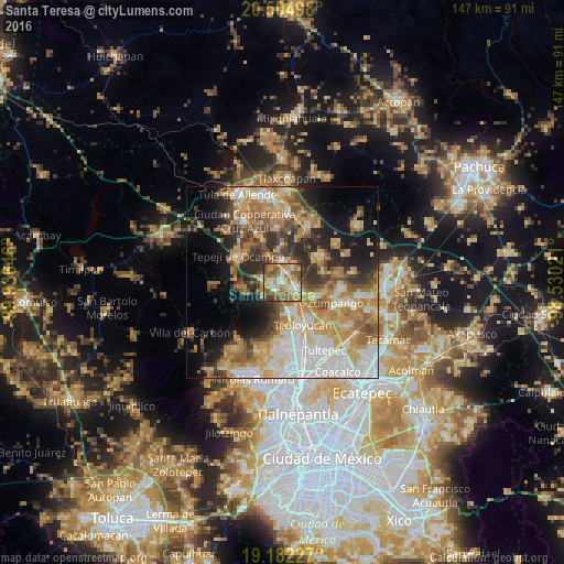
Analysis of Santa Teresa night lights 2016
Square area 10x10 km:
 8.23%
8.23%90-99
12.77%80-89
16.88%70-79
13.2%60-69
17.75%50-59
21%40-49
7.58%30-39
1.95%20-29
0.65%10-19
0%0-9
0%Square area 50x50 km:
9.11%90-99
7.51%80-89
7.31%70-79
8.92%60-69
10.21%50-59
6.07%40-49
6.05%30-39
5.89%20-29
7.96%10-19
10.84%0-9
20.13%Clear (daylight) street map image can be seen on geolist.org.
Map coordinates:
20° 30' 17.9" North, 99° 56' 11.3" West
19° 50' 42" North, 99° 13' 60" West
19° 10' 56.2" North, 98° 31' 48.8" West
Some cities around Santa Teresa sort by population:
• Teoloyucan
12.5 km =7.8 mi,  154°
154°
• Coyotepec
7.8 km =4.8 mi,  164°
164°
• Tequixquiac
11.7 km =7.3 mi,  52°
52°
• San Juan Zitlaltepec
9.9 km =6.2 mi,  111°
111°
• Huehuetoca
3.6 km =2.2 mi,  121°
121°
• Ex-hacienda de Xalpa
5.9 km =3.7 mi, 116°
• San Bartolo
4.5 km =2.8 mi, 107°
• Salitrillo
2.5 km =1.6 mi,  133°
133°
8858090 (p: 36,845)
Sources (retrieved 2019-11-25):
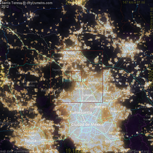
» Earth at Night: Flat Maps 2012, 2016