San Jerónimo Chicahualco night lights from space
Night Light of San Jerónimo Chicahualco (Morelos) from space (Mexico) Src. Average luminocity for 10x10km area is 95.7662% and for 50x50km: 42.5117%.
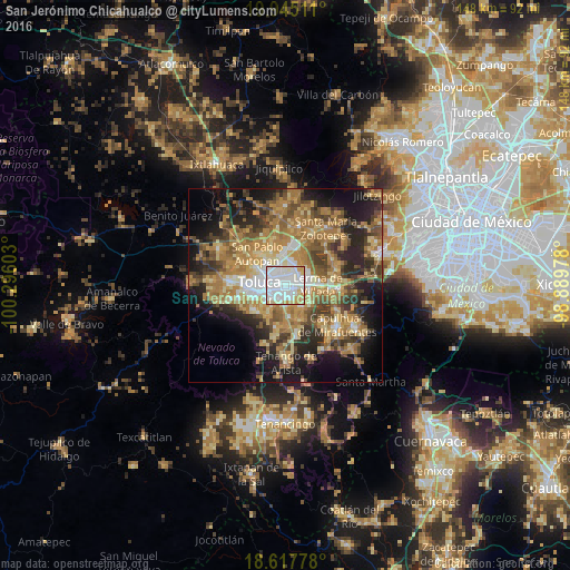
Analysis of San Jerónimo Chicahualco night lights 2016
Square area 10x10 km:
 51.08%
90-99
31.17%80-89
9.96%70-79
7.79%60-69
0%50-59
0%40-49
0%30-39
0%20-29
0%10-19
0%0-9
0%Square area 50x50 km:
4.37%90-99
4.41%80-89
7.39%70-79
8.67%60-69
12.05%50-59
5.93%40-49
7.19%30-39
5.79%20-29
10.05%10-19
13.42%0-9
20.75%Clear (daylight) street map image can be seen on geolist.org.
Map coordinates:
19° 56' 42.4" North, 100° 17' 45.7" West
19° 16' 58" North, 99° 35' 34.4" West
18° 37' 4" North, 98° 53' 23.2" West
Some cities around San Jerónimo Chicahualco sort by population:
• San Salvador Tizatlalli
2.5 km =1.6 mi,  175°
175°
• Metepec
2.8 km =1.7 mi,  199°
199°
• San Francisco Cuaxusco
3.2 km =2 mi,  238°
238°
• San Mateo Otzacatipan
5.7 km =3.5 mi,  348°
348°
• San Pedro Totoltepec
3.8 km =2.4 mi,  34°
34°
• Santa María Totoltepec
2.6 km =1.6 mi,  0°
0°
• Atizapán
5.8 km =3.6 mi,  128°
128°
• San Miguel Totoltepec
4.9 km =3 mi,  19°
19°
3519076 (p: 26,281)
Sources (retrieved 2019-11-25):
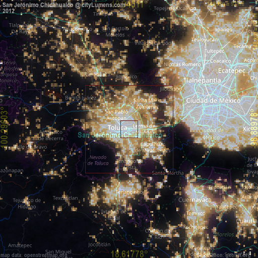
» Earth at Night: Flat Maps 2012, 2016