San Miguel Totoltepec night lights from space
Night Light of San Miguel Totoltepec (Morelos) from space (Mexico) Src. Average luminocity for 10x10km area is 89.5723% and for 50x50km: 44.7178%.
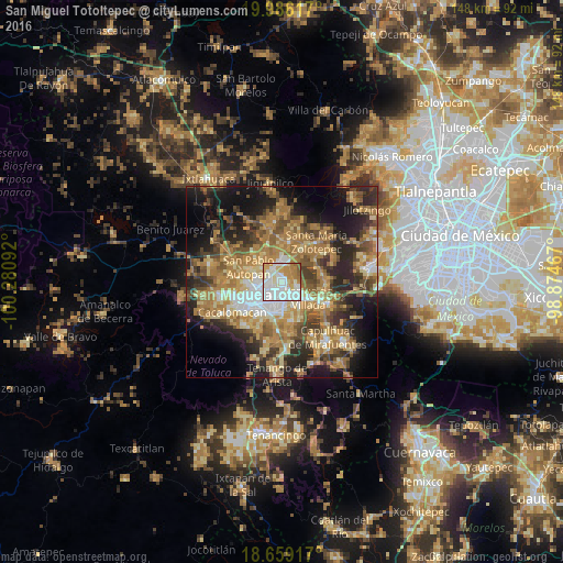
Analysis of San Miguel Totoltepec night lights 2016
Square area 10x10 km:
 35.33%
90-99
29.13%80-89
8.06%70-79
17.77%60-69
6.2%50-59
3.51%40-49
0%30-39
0%20-29
0%10-19
0%0-9
0%Square area 50x50 km:
4.55%90-99
4.62%80-89
7.74%70-79
9.02%60-69
12.49%50-59
6.6%40-49
7.65%30-39
6.11%20-29
11.12%10-19
14.42%0-9
15.68%Clear (daylight) street map image can be seen on geolist.org.
Map coordinates:
19° 59' 10.2" North, 100° 16' 51.3" West
19° 19' 26.5" North, 99° 34' 40" West
18° 39' 33" North, 98° 52' 28.8" West
Some cities around San Miguel Totoltepec sort by population:
• San José Guadalupe Otzacatipan
2.7 km =1.7 mi,  327°
327°
• San Jerónimo Chicahualco
4.9 km =3 mi,  199°
199°
• San Pedro Totoltepec
1.6 km =1 mi,  157°
157°
• Santa María Totoltepec
2.5 km =1.6 mi,  218°
218°
• San Andrés Cuexcontitlán
6 km =3.7 mi,  310°
310°
• El Cerrillo Vista Hermosa
3.7 km =2.3 mi,  91°
91°
• San Nicolás Tolentino
3.9 km =2.4 mi,  9°
9°
• La Constitución Toltepec
4.1 km =2.5 mi,  47°
47°
9513837 (p: 5,471)
Sources (retrieved 2019-11-25):
» Earth at Night: Flat Maps 2012, 2016