San Pedro Totoltepec night lights from space
Night Light of San Pedro Totoltepec (Morelos) from space (Mexico) Src. Average luminocity for 10x10km area is 91.3506% and for 50x50km: 44.3147%.
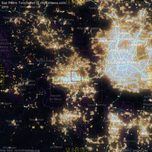
Analysis of San Pedro Totoltepec night lights 2016
Square area 10x10 km:
 38.53%
90-99
33.55%80-89
8.23%70-79
11.47%60-69
5.19%50-59
2.16%40-49
0.87%30-39
0%20-29
0%10-19
0%0-9
0%Square area 50x50 km:
4.56%90-99
4.67%80-89
7.69%70-79
8.92%60-69
12.43%50-59
6.53%40-49
7.43%30-39
5.98%20-29
10.55%10-19
14.18%0-9
17.07%Clear (daylight) street map image can be seen on geolist.org.
Map coordinates:
19° 58' 23.8" North, 100° 16' 30.4" West
19° 18' 39.9" North, 99° 34' 19.1" West
18° 38' 46.2" North, 98° 52' 7.9" West
Some cities around San Pedro Totoltepec sort by population:
• San José Guadalupe Otzacatipan
4.3 km =2.7 mi,  330°
330°
• San Jerónimo Chicahualco
3.8 km =2.4 mi,  214°
214°
• San Mateo Otzacatipan
4.1 km =2.5 mi,  306°
306°
• Santa María Totoltepec
2.2 km =1.4 mi,  256°
256°
• El Cerrillo Vista Hermosa
3.4 km =2.1 mi,  66°
66°
• San Nicolás Tolentino
5.3 km =3.3 mi,  0°
0°
• La Constitución Toltepec
4.8 km =3 mi,  29°
29°
• San Miguel Totoltepec
1.6 km =1 mi,  337°
337°
3827255 (p: 21,076)
Sources (retrieved 2019-11-25):
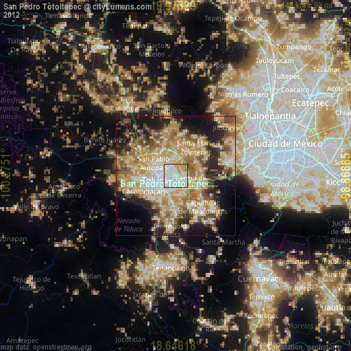
» Earth at Night: Flat Maps 2012, 2016