San Francisco Cuaxusco night lights from space
Night Light of San Francisco Cuaxusco (México) from space (Mexico) Src. Average luminocity for 10x10km area is 93.0065% and for 50x50km: 40.8836%.
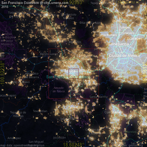
Analysis of San Francisco Cuaxusco night lights 2016
Square area 10x10 km:
 52.16%
90-99
21.65%80-89
8.66%70-79
11.69%60-69
5.19%50-59
0.65%40-49
0%30-39
0%20-29
0%10-19
0%0-9
0%Square area 50x50 km:
4.27%90-99
4.3%80-89
7%70-79
8.44%60-69
11.71%50-59
5.65%40-49
6.62%30-39
5.4%20-29
9.67%10-19
12.88%0-9
24.06%Clear (daylight) street map image can be seen on geolist.org.
Map coordinates:
19° 55' 47.7" North, 100° 19' 20.6" West
19° 16' 3.2" North, 99° 37' 9.3" West
18° 36' 8.9" North, 98° 54' 58.1" West
Some cities around San Francisco Cuaxusco sort by population:
• Toluca
4.2 km =2.6 mi,  302°
302°
• San Salvador Tizatlalli
3.1 km =1.9 mi,  105°
105°
• Metepec
2.1 km =1.3 mi,  116°
116°
• San Jerónimo Chicahualco
3.2 km =2 mi,  58°
58°
• San Jorge Pueblo Nuevo
1.7 km =1.1 mi,  211°
211°
• San Bartolomé Tlaltelulco
4.6 km =2.9 mi,  193°
193°
• San Miguel Totocuitlapilco
5 km =3.1 mi,  148°
148°
• Santa María Magdalena Ocotitlán
3.4 km =2.1 mi, 188°
3827263 (p: 24,900)
Sources (retrieved 2019-11-25):
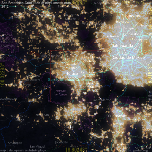
» Earth at Night: Flat Maps 2012, 2016