San Bartolomé Tlaltelulco night lights from space
Night Light of San Bartolomé Tlaltelulco (Morelos) from space (Mexico) Src. Average luminocity for 10x10km area is 75.8485% and for 50x50km: 39.8697%.
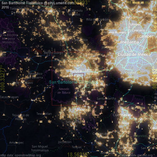
Analysis of San Bartolomé Tlaltelulco night lights 2016
Square area 10x10 km:
 17.32%
90-99
17.32%80-89
12.99%70-79
21%60-69
8.23%50-59
9.52%40-49
4.76%30-39
4.11%20-29
4.55%10-19
0.22%0-9
0%Square area 50x50 km:
4.27%90-99
4.28%80-89
7.16%70-79
8.25%60-69
11.24%50-59
5.23%40-49
5.93%30-39
5.32%20-29
9.64%10-19
11.41%0-9
27.27%Clear (daylight) street map image can be seen on geolist.org.
Map coordinates:
19° 53' 23.7" North, 100° 19' 58" West
19° 13' 38.6" North, 99° 37' 46.7" West
18° 33' 43.7" North, 98° 55' 35.5" West
Some cities around San Bartolomé Tlaltelulco sort by population:
• San Francisco Cuaxusco
4.6 km =2.9 mi,  13°
13°
• San Jorge Pueblo Nuevo
3 km =1.9 mi,  3°
3°
• Santiago Tlacotepec
4.3 km =2.7 mi,  269°
269°
• San Felipe Tlalmimilolpan
1.9 km =1.2 mi,  315°
315°
• San Juan Tilapa
3.3 km =2.1 mi,  256°
256°
• San Miguel Totocuitlapilco
3.7 km =2.3 mi,  87°
87°
• Santa María Magdalena Ocotitlán
1.2 km =0.7 mi,  27°
27°
• Santa María Nativitas
1.8 km =1.1 mi,  179°
179°
3827273 (p: 11,141)
Sources (retrieved 2019-11-25):
» Earth at Night: Flat Maps 2012, 2016