Salto de Agua night lights from space
Night Light of Salto de Agua (Chiapas) from space (Mexico) Src. Average luminocity for 10x10km area is 4.8781% and for 50x50km: 1.0141%.
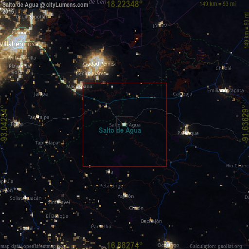
Analysis of Salto de Agua night lights 2016
Square area 10x10 km:
 0.21%
0.21%90-99
1.45%80-89
0.83%70-79
0.83%60-69
0%50-59
0.62%40-49
0.41%30-39
1.03%20-29
1.24%10-19
0%0-9
93.39%Square area 50x50 km:
0.02%90-99
0.11%80-89
0.09%70-79
0.12%60-69
0.11%50-59
0.11%40-49
0.12%30-39
0.41%20-29
0.46%10-19
0.71%0-9
97.74%Clear (daylight) street map image can be seen on geolist.org.
Map coordinates:
18° 13' 24.5" North, 93° 2' 33.1" West
17° 33' 15.7" North, 92° 20' 21.9" West
16° 52' 57.9" North, 91° 38' 10.6" West
Some cities around Salto de Agua sort by population:
• Palenque
38.2 km =23.7 mi,  97°
97°
• Macuspana
35.5 km =22.1 mi,  310°
310°
• San Carlos
37 km =23 mi,  326°
326°
• Tila
29.7 km =18.5 mi,  198°
198°
• Petalcingo
37.3 km =23.2 mi,  192°
192°
• Belén
38.9 km =24.2 mi, 312°
• La Curva
38.1 km =23.7 mi,  335°
335°
• Chilón
36.6 km =22.7 mi, 192°
3520020 (p: 5,199)
Sources (retrieved 2019-11-25):
» Earth at Night: Flat Maps 2012, 2016