Mezcala night lights from space
Night Light of Mezcala (Jalisco) from space (Mexico) Src. Average luminocity for 10x10km area is 3.6856% and for 50x50km: 12.9959%.
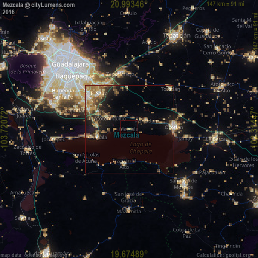
Analysis of Mezcala night lights 2016
Square area 10x10 km:
 0%
0%90-99
0%80-89
0%70-79
0.76%60-69
1.14%50-59
0.38%40-49
0.38%30-39
0.76%20-29
0.76%10-19
0%0-9
95.83%Square area 50x50 km:
0.65%90-99
1.11%80-89
2.78%70-79
2.58%60-69
2.14%50-59
1.47%40-49
3.13%30-39
1.96%20-29
2.76%10-19
7.03%0-9
74.4%Clear (daylight) street map image can be seen on geolist.org.
Map coordinates:
20° 59' 36.5" North, 103° 43' 14.6" West
20° 20' 8.1" North, 103° 1' 3.3" West
19° 40' 29.6" North, 102° 18' 52.1" West
Some cities around Mezcala sort by population:
• Chapala
18.6 km =11.6 mi,  256°
256°
• Tizapán el Alto
19.6 km =12.2 mi,  188°
188°
• Poncitlán
10.8 km =6.7 mi,  62°
62°
• Atotonilquillo
12.8 km =8 mi,  299°
299°
• Atequiza
14.2 km =8.8 mi, 295°
• Ixtlahuacán de los Membrillos
18.4 km =11.4 mi,  274°
274°
• Cuitzeo (La Estancia)
24.4 km =15.2 mi,  88°
88°
• San Pedro Itzicán
6.9 km =4.3 mi,  107°
107°
3996039 (p: 5,005)
Sources (retrieved 2019-11-25):
» Earth at Night: Flat Maps 2012, 2016