Ixtlahuacán de los Membrillos night lights from space
Night Light of Ixtlahuacán de los Membrillos (Jalisco) from space (Mexico) Src. Average luminocity for 10x10km area is 33.6136% and for 50x50km: 23.2216%.
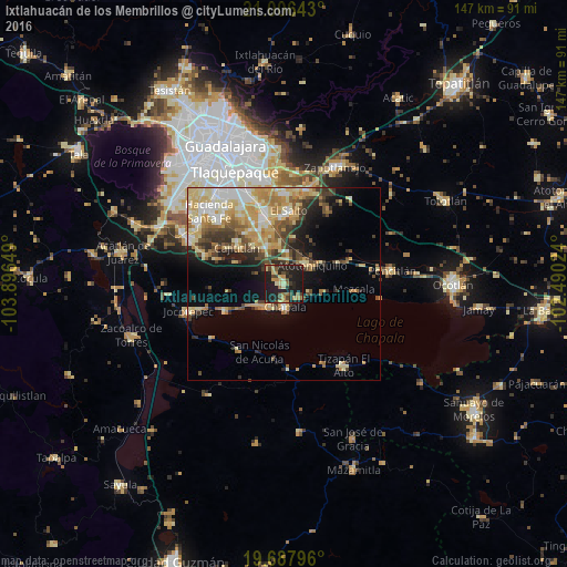
Analysis of Ixtlahuacán de los Membrillos night lights 2016
Square area 10x10 km:
 0%
0%90-99
0.95%80-89
6.82%70-79
6.63%60-69
5.49%50-59
3.41%40-49
9.09%30-39
5.49%20-29
16.48%10-19
45.08%0-9
0.57%Square area 50x50 km:
2.54%90-99
3.17%80-89
5.97%70-79
4.41%60-69
3.32%50-59
2.29%40-49
3.81%30-39
3.03%20-29
3.65%10-19
7.56%0-9
60.26%Clear (daylight) street map image can be seen on geolist.org.
Map coordinates:
21° 0' 23.1" North, 103° 53' 47.4" West
20° 20' 55" North, 103° 11' 36.1" West
19° 41' 16.7" North, 102° 29' 24.9" West
Some cities around Ixtlahuacán de los Membrillos sort by population:
• Chapala
5.8 km =3.6 mi,  177°
177°
• Ajijic
8.1 km =5 mi,  231°
231°
• Capulín
16.4 km =10.2 mi,  331°
331°
• Rancho Alegre [Fraccionamiento]
15.4 km =9.6 mi, 334°
• Los Olivos
11.1 km =6.9 mi,  335°
335°
• Atotonilquillo
8.8 km =5.5 mi,  55°
55°
• Atequiza
7.2 km =4.5 mi,  50°
50°
• Cajititlán
15.2 km =9.4 mi,  307°
307°
4004275 (p: 6,137)
Sources (retrieved 2019-11-25):
» Earth at Night: Flat Maps 2012, 2016