Capulín night lights from space
Night Light of Capulín (Jalisco) from space (Mexico) Src. Average luminocity for 10x10km area is 77.0379% and for 50x50km: 45.1658%.
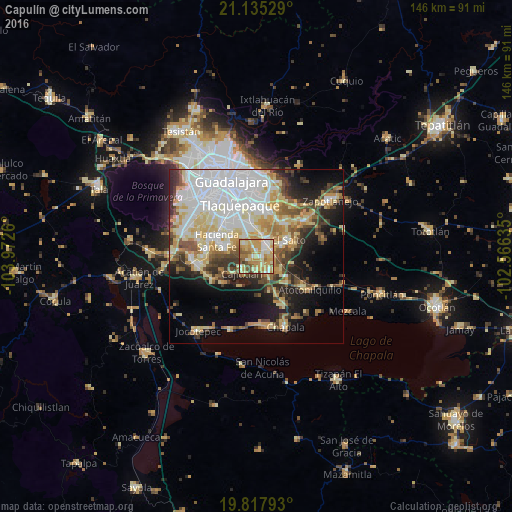
Analysis of Capulín night lights 2016
Square area 10x10 km:
 10.23%
90-99
12.69%80-89
22.92%70-79
25.19%60-69
12.69%50-59
9.09%40-49
5.87%30-39
1.33%20-29
0%10-19
0%0-9
0%Square area 50x50 km:
12.64%90-99
8.11%80-89
8.34%70-79
6.26%60-69
4.26%50-59
3.97%40-49
5.36%30-39
4.55%20-29
6.17%10-19
10.65%0-9
29.69%Clear (daylight) street map image can be seen on geolist.org.
Map coordinates:
21° 8' 7" North, 103° 58' 21.4" West
20° 28' 40.9" North, 103° 16' 10.1" West
19° 49' 4.5" North, 102° 33' 58.9" West
Some cities around Capulín sort by population:
• El Quince
7.5 km =4.7 mi,  347°
347°
• San José del Castillo
5.2 km =3.2 mi,  39°
39°
• Galaxia Bonito Jalisco
7.4 km =4.6 mi,  66°
66°
• La Alameda
2.9 km =1.8 mi,  48°
48°
• Rancho Alegre [Fraccionamiento]
1.3 km =0.8 mi,  111°
111°
• Los Olivos
5.4 km =3.4 mi,  142°
142°
• El Verde
8.7 km =5.4 mi, 353°
• Cajititlán
6.6 km =4.1 mi,  218°
218°
4015514 (p: 8,724)
Sources (retrieved 2019-11-25):
» Earth at Night: Flat Maps 2012, 2016