Huichapan night lights from space
Night Light of Huichapan (Hidalgo) from space (Mexico) Src. Average luminocity for 10x10km area is 17.7178% and for 50x50km: 4.1304%.
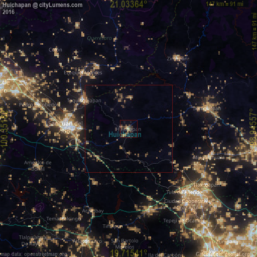
Analysis of Huichapan night lights 2016
Square area 10x10 km:
 0%
0%90-99
1.33%80-89
0.38%70-79
3.03%60-69
5.3%50-59
0.57%40-49
5.68%30-39
8.14%20-29
4.92%10-19
6.63%0-9
64.02%Square area 50x50 km:
0%90-99
0.09%80-89
0.24%70-79
0.53%60-69
0.81%50-59
0.76%40-49
1.13%30-39
1.36%20-29
1.26%10-19
1.96%0-9
91.87%Clear (daylight) street map image can be seen on geolist.org.
Map coordinates:
21° 2' 1.1" North, 100° 21' 6.6" West
20° 22' 33.3" North, 99° 38' 55.3" West
19° 42' 55.5" North, 98° 56' 44.1" West
Some cities around Huichapan sort by population:
• San Juan del Río
36.2 km =22.5 mi,  272°
272°
• Tequisquiapan
30.1 km =18.7 mi,  302°
302°
• Ezequiel Montes
41.4 km =25.7 mi,  320°
320°
• Cadereyta
39.7 km =24.7 mi,  333°
333°
• Tecozautla
17.6 km =10.9 mi,  4°
4°
• Villa Progreso
35.4 km =22 mi, 326°
• San Nicolás
32.1 km =19.9 mi,  290°
290°
• La Llave
37.3 km =23.2 mi, 285°
3526923 (p: 9,051)
Sources (retrieved 2019-11-25):
» Earth at Night: Flat Maps 2012, 2016