Escuintla night lights from space
Night Light of Escuintla (Chiapas) from space (Mexico) Src. Average luminocity for 10x10km area is 8.5826% and for 50x50km: 2.2796%.
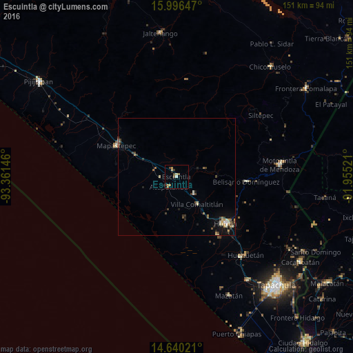
Analysis of Escuintla night lights 2016
Square area 10x10 km:
 0.41%
0.41%90-99
0.41%80-89
2.07%70-79
2.07%60-69
1.65%50-59
1.03%40-49
2.07%30-39
1.03%20-29
0.83%10-19
0%0-9
88.43%Square area 50x50 km:
0.07%90-99
0.36%80-89
0.36%70-79
0.3%60-69
0.31%50-59
0.25%40-49
0.52%30-39
0.41%20-29
0.44%10-19
1.28%0-9
95.7%Clear (daylight) street map image can be seen on geolist.org.
Map coordinates:
15° 59' 47.3" North, 93° 21' 41.3" West
15° 19' 10" North, 92° 39' 30" West
14° 38' 24.8" North, 91° 57' 18.8" West
Some cities around Escuintla sort by population:
• Huixtla
28.9 km =18 mi,  133°
133°
• Motozintla
44.5 km =27.7 mi,  83°
83°
• Mapastepec
28.9 km =18 mi,  296°
296°
• Huehuetán
44.6 km =27.7 mi,  138°
138°
• Acacoyagua
3 km =1.9 mi,  322°
322°
• Villa Comaltitlán
14.6 km =9.1 mi, 143°
• Estación Huehuetán
43.7 km =27.2 mi, 141°
• Acapetahua
5.4 km =3.4 mi,  219°
219°
3527768 (p: 9,570)
Sources (retrieved 2019-11-25):
» Earth at Night: Flat Maps 2012, 2016