Villa Comaltitlán night lights from space
Night Light of Villa Comaltitlán (Chiapas) from space (Mexico) Src. Average luminocity for 10x10km area is 5.7252% and for 50x50km: 2.7974%.
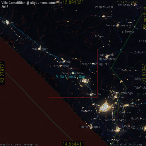
Analysis of Villa Comaltitlán night lights 2016
Square area 10x10 km:
 0.41%
0.41%90-99
1.03%80-89
1.45%70-79
0%60-69
1.24%50-59
0%40-49
1.65%30-39
0.83%20-29
0.83%10-19
0.41%0-9
92.15%Square area 50x50 km:
0.07%90-99
0.44%80-89
0.39%70-79
0.38%60-69
0.35%50-59
0.36%40-49
0.61%30-39
0.48%20-29
0.6%10-19
1.49%0-9
94.83%Clear (daylight) street map image can be seen on geolist.org.
Map coordinates:
15° 53' 28.9" North, 93° 16' 47" West
15° 12' 50.3" North, 92° 34' 35.7" West
14° 32' 3.9" North, 91° 52' 24.5" West
Some cities around Villa Comaltitlán sort by population:
• Huixtla
14.7 km =9.1 mi,  124°
124°
• Motozintla
39.3 km =24.4 mi,  64°
64°
• Escuintla
14.6 km =9.1 mi,  323°
323°
• Huehuetán
30 km =18.6 mi,  136°
136°
• Acacoyagua
17.6 km =10.9 mi, 323°
• Estación Huehuetán
29 km =18 mi, 141°
• Acapetahua
14.3 km =8.9 mi,  301°
301°
• Álvaro Obregón
38.8 km =24.1 mi,  146°
146°
3514685 (p: 7,201)
Sources (retrieved 2019-11-25):
» Earth at Night: Flat Maps 2012, 2016