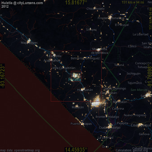
Huixtla night lights from space
Night Light of Huixtla (Chiapas) from space (Mexico) Src. Average luminocity for 10x10km area is 26.6405% and for 50x50km: 4.0569%.
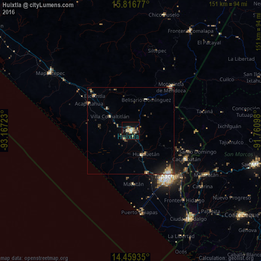
Analysis of Huixtla night lights 2016
Square area 10x10 km:
 1.03%
1.03%90-99
5.79%80-89
4.55%70-79
5.79%60-69
2.48%50-59
1.65%40-49
2.69%30-39
3.72%20-29
3.72%10-19
29.34%0-9
39.26%Square area 50x50 km:
0.17%90-99
0.7%80-89
0.5%70-79
0.5%60-69
0.56%50-59
0.36%40-49
0.88%30-39
0.67%20-29
1.17%10-19
2.57%0-9
91.91%Clear (daylight) street map image can be seen on geolist.org.
Map coordinates:
15° 49' 0.4" North, 93° 10' 2" West
15° 8' 20.9" North, 92° 27' 50.8" West
14° 27' 33.7" North, 91° 45' 39.5" West
Some cities around Huixtla sort by population:
• Escuintla
28.9 km =18 mi,  313°
313°
• Huehuetán
15.9 km =9.9 mi,  146°
146°
• Acacoyagua
31.8 km =19.8 mi, 314°
• Villa Comaltitlán
14.7 km =9.1 mi,  304°
304°
• Mazatán
30.7 km =19.1 mi,  177°
177°
• Estación Huehuetán
15.5 km =9.6 mi,  156°
156°
• Acapetahua
29 km =18 mi, 303°
• Álvaro Obregón
25.8 km =16 mi, 159°
3526855 (p: 32,033)
Sources (retrieved 2019-11-25):
» Earth at Night: Flat Maps 2012, 2016