El Arenal night lights from space
Night Light of El Arenal (Jalisco) from space (Mexico) Src. Average luminocity for 10x10km area is 16.8352% and for 50x50km: 12.1647%.
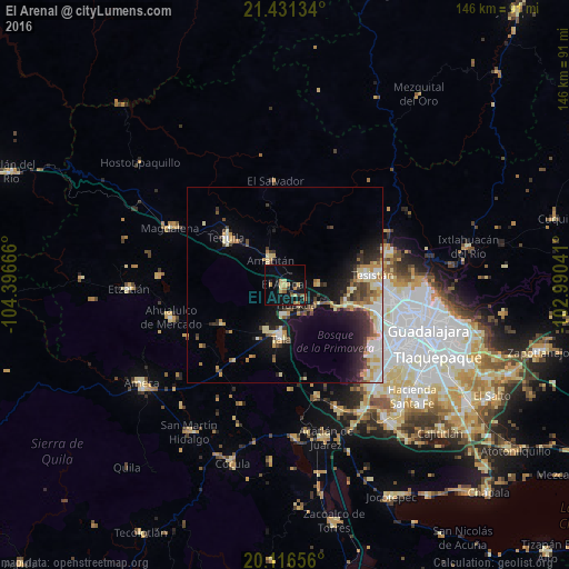
Analysis of El Arenal night lights 2016
Square area 10x10 km:
 0%
0%90-99
0%80-89
4.73%70-79
2.84%60-69
3.41%50-59
2.65%40-49
0.76%30-39
1.33%20-29
1.89%10-19
21.02%0-9
61.36%Square area 50x50 km:
1.46%90-99
1.74%80-89
2.42%70-79
1.76%60-69
1.21%50-59
1.13%40-49
1.84%30-39
1.81%20-29
2.71%10-19
7.58%0-9
76.34%Clear (daylight) street map image can be seen on geolist.org.
Map coordinates:
21° 25' 52.8" North, 104° 23' 48" West
20° 46' 31.4" North, 103° 41' 36.7" West
20° 6' 59.6" North, 102° 59' 25.5" West
Some cities around El Arenal sort by population:
• Tesistán
23.4 km =14.5 mi,  83°
83°
• Tala
13.6 km =8.5 mi,  183°
183°
• Tequila
19 km =11.8 mi,  308°
308°
• Nuevo México
26.1 km =16.2 mi,  94°
94°
• Amatitán
7.6 km =4.7 mi,  329°
329°
• Los Ruiseñores
7.2 km =4.5 mi, 178°
• El Refugio
12.5 km =7.8 mi,  202°
202°
• La Venta del Astillero
16.3 km =10.1 mi,  108°
108°
4011119 (p: 11,610)
Sources (retrieved 2019-11-25):
» Earth at Night: Flat Maps 2012, 2016