Tala night lights from space
Night Light of Tala (Jalisco) from space (Mexico) Src. Average luminocity for 10x10km area is 25.1383% and for 50x50km: 14.6648%.
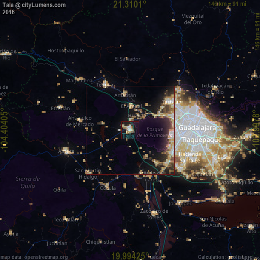
Analysis of Tala night lights 2016
Square area 10x10 km:
 2.08%
2.08%90-99
3.6%80-89
5.68%70-79
3.79%60-69
0.76%50-59
0.95%40-49
5.11%30-39
2.84%20-29
2.65%10-19
37.31%0-9
35.23%Square area 50x50 km:
1.19%90-99
1.62%80-89
3.03%70-79
2.3%60-69
1.8%50-59
1.61%40-49
2.42%30-39
2.55%20-29
4%10-19
10.11%0-9
69.38%Clear (daylight) street map image can be seen on geolist.org.
Map coordinates:
21° 18' 36.4" North, 104° 24' 14.6" West
20° 39' 13" North, 103° 42' 3.3" West
19° 59' 39.3" North, 102° 59' 52.1" West
Some cities around Tala sort by population:
• Nicolás R Casillas
27.2 km =16.9 mi,  116°
116°
• El Arenal
13.6 km =8.5 mi,  3°
3°
• Amatitán
20.3 km =12.6 mi,  351°
351°
• Villa Corona
26.7 km =16.6 mi,  171°
171°
• Los Ruiseñores
6.4 km =4 mi,  8°
8°
• Bellavista
25.3 km =15.7 mi,  164°
164°
• El Refugio
4.5 km =2.8 mi,  296°
296°
• La Venta del Astillero
18.2 km =11.3 mi,  62°
62°
3982616 (p: 35,396)
Sources (retrieved 2019-11-25):
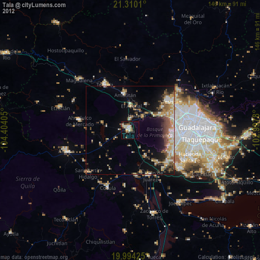
» Earth at Night: Flat Maps 2012, 2016