Cuernavaca night lights from space
Night Light of Cuernavaca (Morelos) from space (Mexico) Src. Average luminocity for 10x10km area is 81.9177% and for 50x50km: 25.9644%.
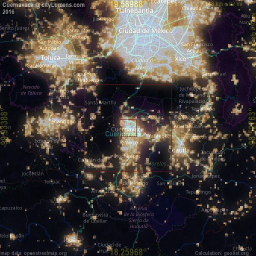
Analysis of Cuernavaca night lights 2016
Square area 10x10 km:
 13.85%
90-99
32.03%80-89
21%70-79
14.29%60-69
4.76%50-59
2.81%40-49
5.84%30-39
2.81%20-29
2.6%10-19
0%0-9
0%Square area 50x50 km:
1.32%90-99
2.95%80-89
5.35%70-79
4.66%60-69
4.62%50-59
2.79%40-49
5.48%30-39
4.17%20-29
8.32%10-19
15.27%0-9
45.07%Clear (daylight) street map image can be seen on geolist.org.
Map coordinates:
19° 35' 23.6" North, 99° 56' 2" West
18° 55' 34" North, 99° 13' 50.7" West
18° 15' 34.8" North, 98° 31' 39.5" West
Some cities around Cuernavaca sort by population:
• Jiutepec
7.5 km =4.7 mi,  131°
131°
• Temixco
8.2 km =5.1 mi,  176°
176°
• Emiliano Zapata
10.7 km =6.6 mi,  152°
152°
• Tres de Mayo
6.8 km =4.2 mi,  159°
159°
• Progreso
9.7 km =6 mi,  121°
121°
• La Joya
12 km =7.5 mi,  109°
109°
• Fraccionamiento Lomas de Ahuatlán
4.2 km =2.6 mi,  318°
318°
• Calera Chica
9.1 km =5.7 mi, 145°
3529947 (p: 338,650)
Sources (retrieved 2019-11-25):
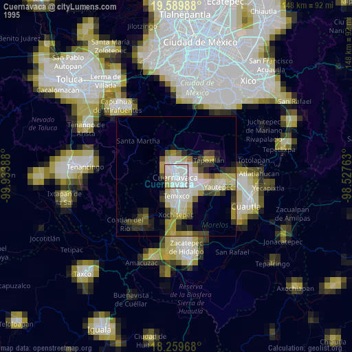
» NASA, Earths city lights 1995
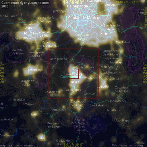
» NASA city lights 2003
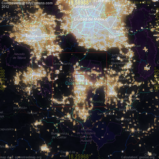
» Earth at Night: Flat Maps 2012, 2016