Benito Juarez night lights from space
Night Light of Benito Juarez (Mexico City) from space (Mexico) Src. Average luminocity for 10x10km area is 100% and for 50x50km: 80.3007%.
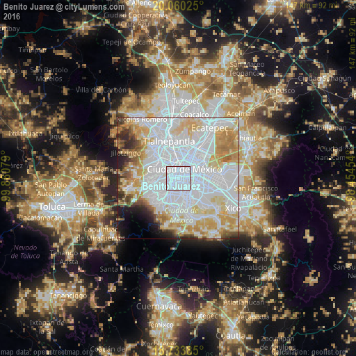
Analysis of Benito Juarez night lights 2016
Square area 10x10 km:
 100%
100%90-99
0%80-89
0%70-79
0%60-69
0%50-59
0%40-49
0%30-39
0%20-29
0%10-19
0%0-9
0%Square area 50x50 km:
42.48%90-99
13.83%80-89
11%70-79
8.97%60-69
5.53%50-59
2.53%40-49
2.86%30-39
2.3%20-29
3.05%10-19
3.08%0-9
4.37%Clear (daylight) street map image can be seen on geolist.org.
Map coordinates:
20° 3' 36.9" North, 99° 51' 38.8" West
19° 23' 54.2" North, 99° 9' 27.6" West
18° 44' 1.9" North, 98° 27' 16.3" West
Some cities around Benito Juarez sort by population:
• Mexico City
4.6 km =2.9 mi,  43°
43°
• Coyoacán
5.8 km =3.6 mi,  184°
184°
• Cuauhtémoc
5.3 km =3.3 mi,  13°
13°
• Iztacalco
6.3 km =3.9 mi,  93°
93°
• Miguel Hidalgo
6 km =3.7 mi,  311°
311°
• Colonia del Valle
1.4 km =0.9 mi,  198°
198°
• Colonia Nativitas
2.9 km =1.8 mi,  131°
131°
• Polanco
5.8 km =3.6 mi, 311°
3827406 (p: 355,017)
Sources (retrieved 2019-11-25):
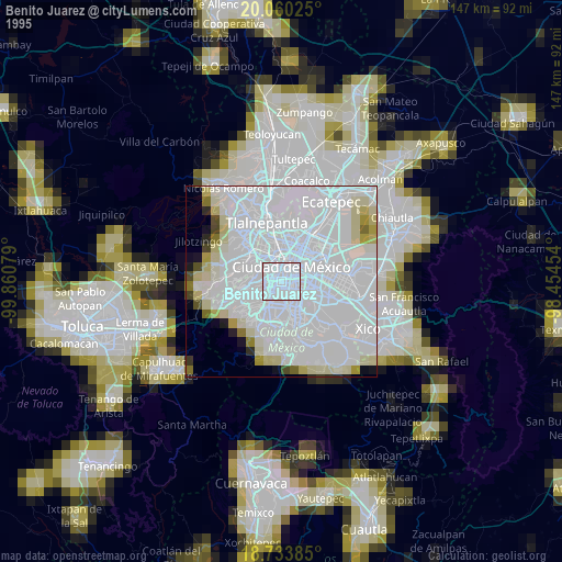
» NASA, Earths city lights 1995
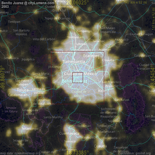
» NASA city lights 2003
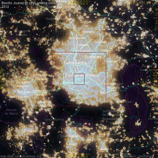
» Earth at Night: Flat Maps 2012, 2016