Coronango night lights from space
Night Light of Coronango (Puebla) from space (Mexico) Src. Average luminocity for 10x10km area is 80.2078% and for 50x50km: 58.7074%.
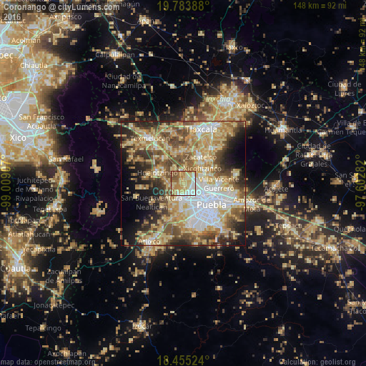
Analysis of Coronango night lights 2016
Square area 10x10 km:
 11.26%
90-99
15.37%80-89
27.92%70-79
22.51%60-69
9.09%50-59
12.99%40-49
0.43%30-39
0.43%20-29
0%10-19
0%0-9
0%Square area 50x50 km:
10.35%90-99
8.55%80-89
15.61%70-79
10.35%60-69
8.37%50-59
8.39%40-49
8.82%30-39
5.87%20-29
7.12%10-19
7.8%0-9
8.77%Clear (daylight) street map image can be seen on geolist.org.
Map coordinates:
19° 47' 2" North, 99° 0' 32.7" West
19° 7' 15.2" North, 98° 18' 21.4" West
18° 27' 18.9" North, 97° 36' 10.2" West
Some cities around Coronango sort by population:
• Cholula
6.3 km =3.9 mi,  177°
177°
• Sanctorum
6 km =3.7 mi,  113°
113°
• Cuautlancingo
4.9 km =3 mi,  135°
135°
• Santa María Zacatepec
6.2 km =3.9 mi,  272°
272°
• San Francisco Ocotlán
2.8 km =1.7 mi,  58°
58°
• San Miguel Xoxtla
5.2 km =3.2 mi,  358°
358°
• San Antonio Mihuacán
3.6 km =2.2 mi,  2°
2°
• Cuanalá
2.6 km =1.6 mi,  240°
240°
3517265 (p: 14,859)
Sources (retrieved 2019-11-25):
» Earth at Night: Flat Maps 2012, 2016