Constancia night lights from space
Night Light of Constancia (Sinaloa) from space (Mexico) Src. Average luminocity for 10x10km area is 7.8075% and for 50x50km: 7.8974%.
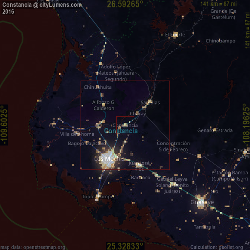
Analysis of Constancia night lights 2016
Square area 10x10 km:
 0%
0%90-99
0%80-89
0.79%70-79
2.38%60-69
2.78%50-59
0.79%40-49
1.98%30-39
0.79%20-29
1.19%10-19
0.4%0-9
88.89%Square area 50x50 km:
0.93%90-99
1.03%80-89
1.45%70-79
1.19%60-69
0.79%50-59
0.88%40-49
1.43%30-39
1.04%20-29
2.1%10-19
3.24%0-9
85.91%Clear (daylight) street map image can be seen on geolist.org.
Map coordinates:
26° 35' 33.5" North, 109° 36' 9" West
25° 57' 43.9" North, 108° 53' 57.7" West
25° 19' 42" North, 108° 11' 46.5" West
Some cities around Constancia sort by population:
• Los Mochis
21.2 km =13.2 mi,  207°
207°
• Juan José Ríos
23.9 km =14.9 mi,  161°
161°
• Adolfo Ruiz Cortines
34 km =21.1 mi,  148°
148°
• Adolfo Ruíz Cortínes
27.9 km =17.3 mi, 147°
• Ahome
27.8 km =17.3 mi,  260°
260°
• San Blas
19.1 km =11.9 mi,  46°
46°
• San Miguel Zapotitlan
14.9 km =9.3 mi, 264°
• Mochicahui
3.3 km =2.1 mi,  247°
247°
4002789 (p: 6,500)
Sources (retrieved 2019-11-25):
» Earth at Night: Flat Maps 2012, 2016