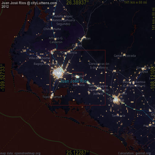
Juan José Ríos night lights from space
Night Light of Juan José Ríos (Sinaloa) from space (Mexico) Src. Average luminocity for 10x10km area is 12.1477% and for 50x50km: 9.1546%.
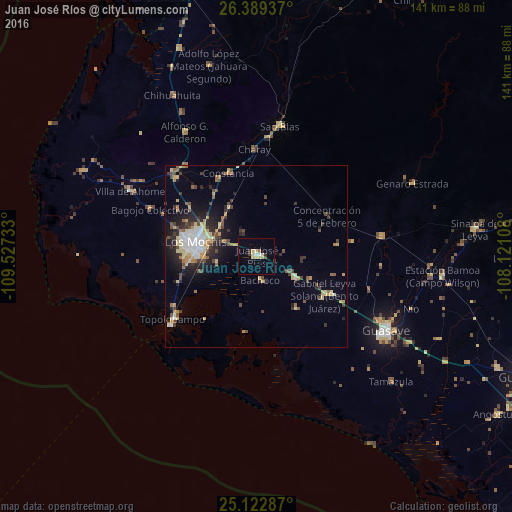
Analysis of Juan José Ríos night lights 2016
Square area 10x10 km:
 0.38%
0.38%90-99
1.14%80-89
4.73%70-79
1.7%60-69
0.76%50-59
0%40-49
0.76%30-39
1.33%20-29
1.33%10-19
0%0-9
87.88%Square area 50x50 km:
1%90-99
1.19%80-89
1.73%70-79
1.39%60-69
0.73%50-59
0.86%40-49
1.73%30-39
1.16%20-29
2.58%10-19
4.14%0-9
83.5%Clear (daylight) street map image can be seen on geolist.org.
Map coordinates:
26° 23' 21.7" North, 109° 31' 38.4" West
25° 45' 28.1" North, 108° 49' 27.1" West
25° 7' 22.3" North, 108° 7' 15.9" West
Some cities around Juan José Ríos sort by population:
• Los Mochis
17.8 km =11.1 mi,  282°
282°
• Leyva Solano
21.6 km =13.4 mi,  119°
119°
• Adolfo Ruiz Cortines
12.1 km =7.5 mi, 120°
• Adolfo Ruíz Cortínes
7.5 km =4.7 mi,  96°
96°
• Constancia
23.9 km =14.9 mi,  341°
341°
• Topolobampo
28.8 km =17.9 mi,  232°
232°
• San Miguel Zapotitlan
30.8 km =19.1 mi,  313°
313°
• Mochicahui
23.9 km =14.9 mi,  333°
333°
4005864 (p: 23,553)
Sources (retrieved 2019-11-25):
» Earth at Night: Flat Maps 2012, 2016