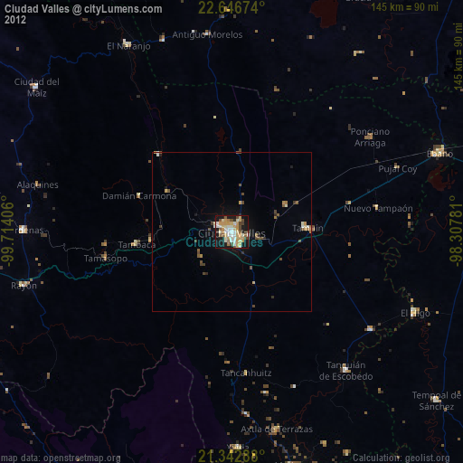
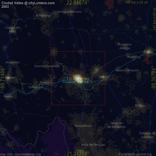
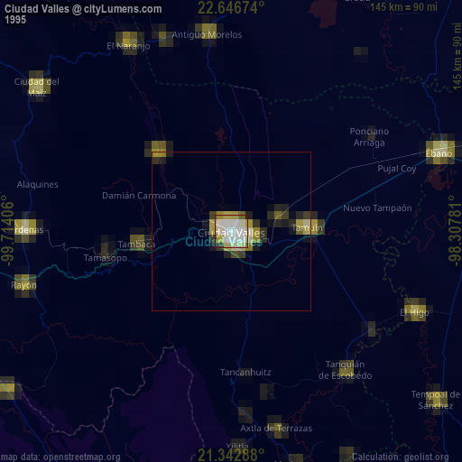
Ciudad Valles night lights from space
Night Light of Ciudad Valles (San Luis Potosí) from space (Mexico) Src. Average luminocity for 10x10km area is 49.7937% and for 50x50km: 3.4335%.

Analysis of Ciudad Valles night lights 2016
Square area 10x10 km:
 3.57%
3.57%90-99
8.53%80-89
12.1%70-79
10.91%60-69
9.33%50-59
5.75%40-49
3.17%30-39
7.94%20-29
7.14%10-19
30.36%0-9
1.19%Square area 50x50 km:
0.16%90-99
0.37%80-89
0.68%70-79
0.52%60-69
0.52%50-59
0.39%40-49
0.52%30-39
0.61%20-29
0.57%10-19
3.09%0-9
92.56%Clear (daylight) street map image can be seen on geolist.org.
Map coordinates:
22° 38' 48.3" North, 99° 42' 50.6" West
21° 59' 46.7" North, 99° 0' 39.3" West
21° 20' 34.4" North, 98° 18' 28.1" West
Some cities around Ciudad Valles sort by population:
• Tamuín
23.9 km =14.9 mi,  87°
87°
• Cárdenas
65.1 km =40.5 mi,  270°
270°
• Tanquián de Escobedo
56.4 km =35 mi,  140°
140°
• El Higo
63.1 km =39.2 mi,  113°
113°
• Axtla de Terrazas
63.5 km =39.5 mi,  167°
167°
• Ponciano Arriaga
52.5 km =32.6 mi,  55°
55°
• San Vicente Tancuayalab
53.5 km =33.2 mi,  125°
125°
• Rayón
67.3 km =41.8 mi,  255°
255°
3483849 (p: 124,644)
Sources (retrieved 2019-11-25):
» NASA, Earths city lights 1995
» NASA city lights 2003
» Earth at Night: Flat Maps 2012, 2016