Ciudad de Huajuapan de León night lights from space
Night Light of Ciudad de Huajuapan de León (Oaxaca) from space (Mexico) Src. Average luminocity for 10x10km area is 41.1797% and for 50x50km: 3.0512%.
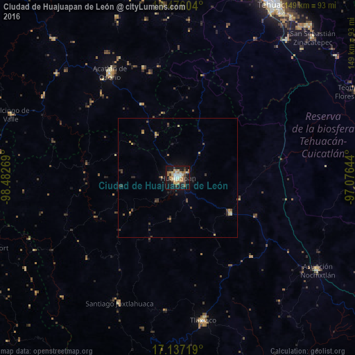
Analysis of Ciudad de Huajuapan de León night lights 2016
Square area 10x10 km:
 1.95%
1.95%90-99
8.01%80-89
8.87%70-79
5.41%60-69
11.9%50-59
2.81%40-49
3.46%30-39
4.98%20-29
5.41%10-19
41.13%0-9
6.06%Square area 50x50 km:
0.07%90-99
0.34%80-89
0.59%70-79
0.34%60-69
0.68%50-59
0.19%40-49
0.57%30-39
0.62%20-29
0.7%10-19
2.31%0-9
93.59%Clear (daylight) street map image can be seen on geolist.org.
Map coordinates:
18° 28' 33.7" North, 98° 28' 57.7" West
17° 48' 28.3" North, 97° 46' 46.4" West
17° 8' 13.9" North, 97° 4' 35.2" West
Some cities around Ciudad de Huajuapan de León sort by population:
• Heroica Ciudad de Tlaxiaco
60.8 km =37.8 mi,  170°
170°
• Acatlán de Osorio
52.3 km =32.5 mi,  327°
327°
• Asunción Nochixtlán
70.3 km =43.7 mi,  123°
123°
• San Gabriel Chilac
73.5 km =45.7 mi,  38°
38°
• Santiago Juxtlahuaca
58.1 km =36.1 mi,  205°
205°
• Miahuatlán
74.8 km =46.5 mi, 44°
• Tulcingo de Valle
74.7 km =46.4 mi,  290°
290°
• Tamazulapam Villa del Progreso
26.3 km =16.3 mi, 123°
3527023 (p: 53,043)
Sources (retrieved 2019-11-25):
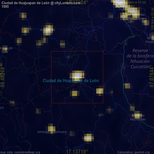
» NASA, Earths city lights 1995
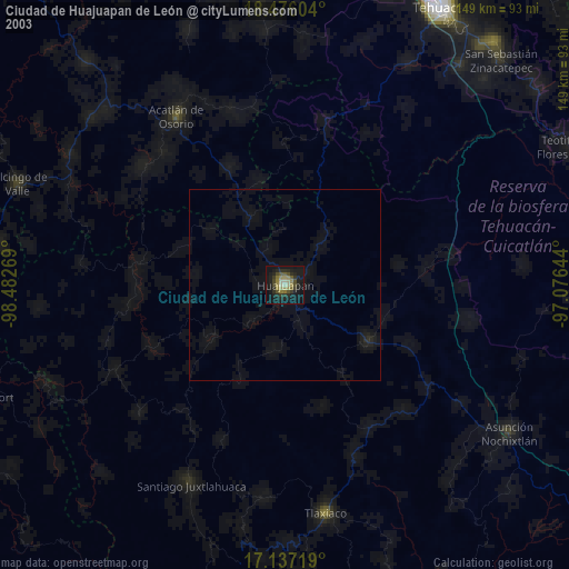
» NASA city lights 2003
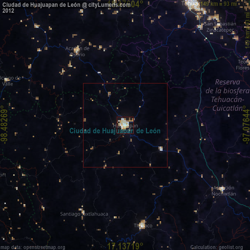
» Earth at Night: Flat Maps 2012, 2016