Acatlán de Osorio night lights from space
Night Light of Acatlán de Osorio (Puebla) from space (Mexico) Src. Average luminocity for 10x10km area is 22.5541% and for 50x50km: 2.858%.
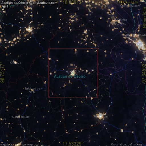
Analysis of Acatlán de Osorio night lights 2016
Square area 10x10 km:
 0.65%
0.65%90-99
1.95%80-89
6.93%70-79
3.46%60-69
3.46%50-59
0.87%40-49
4.33%30-39
4.33%20-29
1.08%10-19
14.72%0-9
58.23%Square area 50x50 km:
0.02%90-99
0.07%80-89
0.57%70-79
0.44%60-69
0.48%50-59
0.32%40-49
1.02%30-39
0.61%20-29
0.57%10-19
0.98%0-9
94.9%Clear (daylight) street map image can be seen on geolist.org.
Map coordinates:
18° 52' 8.9" North, 98° 45' 6.4" West
18° 12' 9" North, 98° 2' 55.1" West
17° 31' 59.8" North, 97° 20' 43.9" West
Some cities around Acatlán de Osorio sort by population:
• Ciudad de Huajuapan de León
52.3 km =32.5 mi,  147°
147°
• Izúcar de Matamoros
62.2 km =38.6 mi,  315°
315°
• Chiautla de Tapia
59.6 km =37 mi,  280°
280°
• Ciudad de Chiautla de Tapia
59.6 km =37 mi, 280°
• Santa María la Alta
60.4 km =37.5 mi,  43°
43°
• Tehuitzingo
28 km =17.4 mi,  300°
300°
• Tulcingo de Valle
45 km =28 mi,  246°
246°
• Xochitlan Todos Santos
62.7 km =39 mi,  27°
27°
3533440 (p: 16,307)
Sources (retrieved 2019-11-25):
» Earth at Night: Flat Maps 2012, 2016