Tamazulapam Villa del Progreso night lights from space
Night Light of Tamazulapam Villa del Progreso (Oaxaca) from space (Mexico) Src. Average luminocity for 10x10km area is 5.6632% and for 50x50km: 2.4632%.
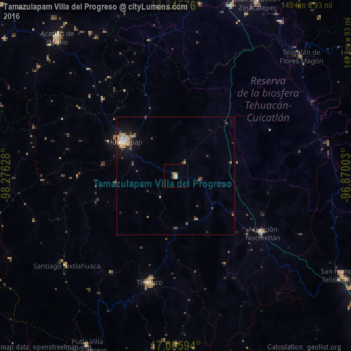
Analysis of Tamazulapam Villa del Progreso night lights 2016
Square area 10x10 km:
 0%
0%90-99
1.03%80-89
1.45%70-79
1.65%60-69
0%50-59
0.83%40-49
0.83%30-39
0.41%20-29
1.24%10-19
0%0-9
92.56%Square area 50x50 km:
0.07%90-99
0.34%80-89
0.45%70-79
0.33%60-69
0.54%50-59
0.22%40-49
0.45%30-39
0.46%20-29
0.45%10-19
1.69%0-9
94.99%Clear (daylight) street map image can be seen on geolist.org.
Map coordinates:
18° 20' 44.7" North, 98° 16' 34.6" West
17° 40' 37.6" North, 97° 34' 23.3" West
17° 0' 21.4" North, 96° 52' 12.1" West
Some cities around Tamazulapam Villa del Progreso sort by population:
• Ciudad de Huajuapan de León
26.3 km =16.3 mi,  303°
303°
• Heroica Ciudad de Tlaxiaco
46.8 km =29.1 mi,  194°
194°
• Acatlán de Osorio
77.1 km =47.9 mi,  319°
319°
• Asunción Nochixtlán
44.1 km =27.4 mi,  123°
123°
• San Gabriel Chilac
76 km =47.2 mi,  18°
18°
• Santiago Juxtlahuaca
60.1 km =37.3 mi,  230°
230°
• Miahuatlán
74.7 km =46.4 mi, 23°
• Teotitlán
73.4 km =45.6 mi,  46°
46°
3801045 (p: 5,028)
Sources (retrieved 2019-11-25):
» Earth at Night: Flat Maps 2012, 2016