Asunción Nochixtlán night lights from space
Night Light of Asunción Nochixtlán (Oaxaca) from space (Mexico) Src. Average luminocity for 10x10km area is 8.7273% and for 50x50km: 0.7313%.
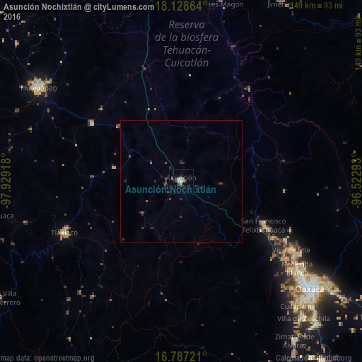
Analysis of Asunción Nochixtlán night lights 2016
Square area 10x10 km:
 0%
0%90-99
0.62%80-89
2.27%70-79
2.07%60-69
0%50-59
0.83%40-49
3.51%30-39
1.45%20-29
1.65%10-19
0%0-9
87.6%Square area 50x50 km:
0%90-99
0.02%80-89
0.09%70-79
0.08%60-69
0.08%50-59
0.08%40-49
0.29%30-39
0.27%20-29
0.41%10-19
0.16%0-9
98.51%Clear (daylight) street map image can be seen on geolist.org.
Map coordinates:
18° 7' 43.1" North, 97° 55' 45" West
17° 27' 33" North, 97° 13' 33.8" West
16° 47' 14" North, 96° 31' 22.5" West
Some cities around Asunción Nochixtlán sort by population:
• Heroica Ciudad de Tlaxiaco
52.7 km =32.7 mi,  246°
246°
• San Francisco Telixtlahuaca
38.5 km =23.9 mi,  117°
117°
• Hacienda Blanca
59.5 km =37 mi,  126°
126°
• San Lorenzo Cacaotepec
58.1 km =36.1 mi, 129°
• Villa de Etla
53.4 km =33.2 mi, 121°
• Santiago Suchilquitongo
43.4 km =27 mi, 121°
• San Pablo Huitzo
41.3 km =25.7 mi, 119°
• Tamazulapam Villa del Progreso
44.1 km =27.4 mi,  303°
303°
3532656 (p: 13,284)
Sources (retrieved 2019-11-25):
» Earth at Night: Flat Maps 2012, 2016