Choix night lights from space
Night Light of Choix (Sinaloa) from space (Mexico) Src. Average luminocity for 10x10km area is 7.619% and for 50x50km: 0.5086%.
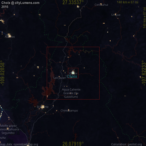
Analysis of Choix night lights 2016
Square area 10x10 km:
 0.4%
0.4%90-99
1.79%80-89
1.79%70-79
0.79%60-69
0.6%50-59
0.99%40-49
1.19%30-39
1.19%20-29
0%10-19
0.79%0-9
90.48%Square area 50x50 km:
0.02%90-99
0.07%80-89
0.09%70-79
0.04%60-69
0.08%50-59
0.04%40-49
0.17%30-39
0.19%20-29
0.06%10-19
0.08%0-9
99.17%Clear (daylight) street map image can be seen on geolist.org.
Map coordinates:
27° 20' 7.3" North, 109° 1' 42.9" West
26° 42' 32.4" North, 108° 19' 31.6" West
26° 4' 45.1" North, 107° 37' 20.4" West
Some cities around Choix sort by population:
• El Fuerte
43.6 km =27.1 mi,  221°
221°
• Álamos
69.8 km =43.4 mi,  300°
300°
• Constancia
100.8 km =62.6 mi,  214°
214°
• Naranjo
101.6 km =63.1 mi,  188°
188°
• San Blas
82.3 km =51.1 mi, 211°
• San Miguel Zapotitlan
111 km =69 mi, 220°
• Mochicahui
103.6 km =64.4 mi, 215°
• Sinaloa de Leyva
99.2 km =61.6 mi,  174°
174°
4014109 (p: 9,306)
Sources (retrieved 2019-11-25):
» Earth at Night: Flat Maps 2012, 2016