Sinaloa de Leyva night lights from space
Night Light of Sinaloa de Leyva (Sinaloa) from space (Mexico) Src. Average luminocity for 10x10km area is 9.4299% and for 50x50km: 1.5838%.
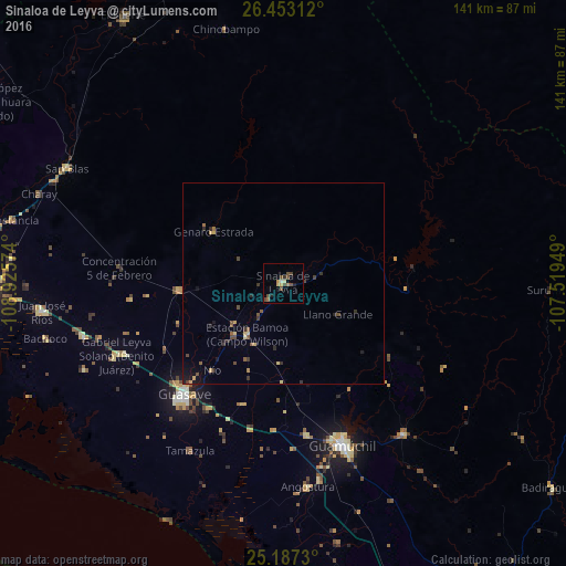
Analysis of Sinaloa de Leyva night lights 2016
Square area 10x10 km:
 0%
0%90-99
0.95%80-89
1.89%70-79
0.95%60-69
1.33%50-59
0.76%40-49
5.87%30-39
1.14%20-29
0.76%10-19
0.76%0-9
85.61%Square area 50x50 km:
0%90-99
0.04%80-89
0.3%70-79
0.22%60-69
0.12%50-59
0.34%40-49
0.56%30-39
0.36%20-29
0.34%10-19
0.55%0-9
97.17%Clear (daylight) street map image can be seen on geolist.org.
Map coordinates:
26° 27' 11.2" North, 108° 55' 32.7" West
25° 49' 18.8" North, 108° 13' 21.4" West
25° 11' 14.3" North, 107° 31' 10.2" West
Some cities around Sinaloa de Leyva sort by population:
• Guasave
37.5 km =23.3 mi,  220°
220°
• Guamúchil
42.9 km =26.7 mi,  160°
160°
• Leyva Solano
45.2 km =28.1 mi,  246°
246°
• Adolfo Ruiz Cortines
51.5 km =32 mi,  255°
255°
• Estacion Bamoa
15.5 km =9.6 mi, 215°
• Naranjo
25.9 km =16.1 mi,  266°
266°
• Mocorito
48.5 km =30.1 mi,  141°
141°
• Angostura
51.1 km =31.8 mi,  173°
173°
3983032 (p: 5,240)
Sources (retrieved 2019-11-25):
» Earth at Night: Flat Maps 2012, 2016