Chetumal night lights from space
Night Light of Chetumal (Quintana Roo) from space (Mexico) Src. Average luminocity for 10x10km area is 55.4587% and for 50x50km: 5.8538%.
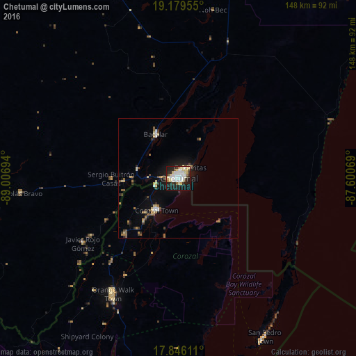
Analysis of Chetumal night lights 2016
Square area 10x10 km:
 14.88%
90-99
15.08%80-89
12.6%70-79
3.1%60-69
1.65%50-59
2.89%40-49
2.89%30-39
3.51%20-29
17.36%10-19
24.38%0-9
1.65%Square area 50x50 km:
0.74%90-99
0.81%80-89
1.13%70-79
0.55%60-69
0.66%50-59
0.62%40-49
0.63%30-39
0.54%20-29
1.16%10-19
4.18%0-9
88.98%Clear (daylight) street map image can be seen on geolist.org.
Map coordinates:
19° 10' 46.4" North, 89° 0' 25" West
18° 30' 50.9" North, 88° 18' 13.7" West
17° 50' 46" North, 87° 36' 2.5" West
Some cities around Chetumal sort by population:
• Belize City, BZ
113.4 km =70.5 mi,  174°
174°
• Felipe Carrillo Puerto
121.3 km =75.4 mi,  12°
12°
• Orange Walk, BZ
55.4 km =34.4 mi,  209°
209°
• José María Morelos
143.7 km =89.3 mi,  342°
342°
• Bacalar
20.8 km =12.9 mi,  333°
333°
• Corozal, BZ
16.1 km =10 mi, 213°
• San Pedro, BZ
75.5 km =46.9 mi,  151°
151°
• Calderitas
6.9 km =4.3 mi,  48°
48°
3531023 (p: 151,243)
Sources (retrieved 2019-11-25):
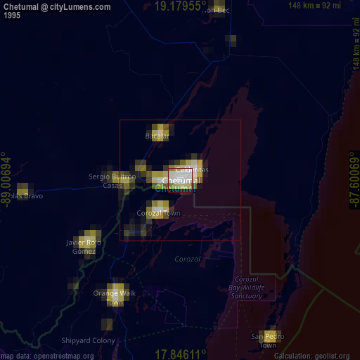
» NASA, Earths city lights 1995
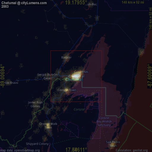
» NASA city lights 2003
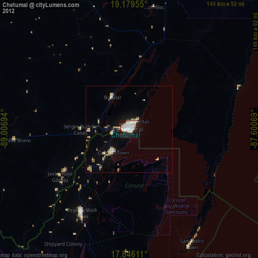
» Earth at Night: Flat Maps 2012, 2016