Cerritos night lights from space
Night Light of Cerritos (San Luis Potosí) from space (Mexico) Src. Average luminocity for 10x10km area is 6.6932% and for 50x50km: 0.6578%.
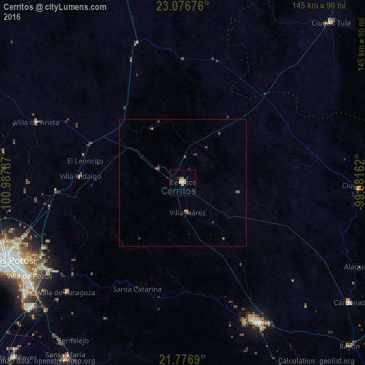
Analysis of Cerritos night lights 2016
Square area 10x10 km:
 0.57%
0.57%90-99
0.19%80-89
1.52%70-79
0.76%60-69
3.03%50-59
0.57%40-49
0.19%30-39
0.76%20-29
0%10-19
1.52%0-9
90.91%Square area 50x50 km:
0.02%90-99
0.01%80-89
0.06%70-79
0.14%60-69
0.22%50-59
0.06%40-49
0.23%30-39
0.15%20-29
0.12%10-19
0.18%0-9
98.81%Clear (daylight) street map image can be seen on geolist.org.
Map coordinates:
23° 4' 36.3" North, 100° 59' 16.3" West
22° 25' 42.1" North, 100° 17' 5.1" West
21° 46' 36.8" North, 99° 34' 53.8" West
Some cities around Cerritos sort by population:
• San Luis Potosí
77.9 km =48.4 mi,  246°
246°
• Soledad de Graciano Sánchez
72.3 km =44.9 mi, 248°
• Rioverde
62.8 km =39 mi,  151°
151°
• Ciudad Fernández
61.1 km =38 mi, 152°
• Ciudad del Maíz
70 km =43.5 mi,  92°
92°
• Villa Zaragoza
63.2 km =39.3 mi,  226°
226°
• Villa de Arista
62.6 km =38.9 mi,  292°
292°
• La Pila
74.3 km =46.2 mi, 233°
4014795 (p: 14,804)
Sources (retrieved 2019-11-25):
» Earth at Night: Flat Maps 2012, 2016