Rioverde night lights from space
Night Light of Rioverde (San Luis Potosí) from space (Mexico) Src. Average luminocity for 10x10km area is 35.6607% and for 50x50km: 2.2185%.
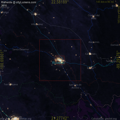
Analysis of Rioverde night lights 2016
Square area 10x10 km:
 2.58%
2.58%90-99
4.37%80-89
5.75%70-79
6.55%60-69
7.74%50-59
4.76%40-49
3.97%30-39
5.95%20-29
6.15%10-19
38.89%0-9
13.29%Square area 50x50 km:
0.1%90-99
0.18%80-89
0.23%70-79
0.33%60-69
0.38%50-59
0.28%40-49
0.47%30-39
0.53%20-29
0.44%10-19
1.98%0-9
95.07%Clear (daylight) street map image can be seen on geolist.org.
Map coordinates:
22° 34' 54.8" North, 100° 41' 52.8" West
21° 55' 52.1" North, 99° 59' 41.6" West
21° 16' 38.7" North, 99° 17' 30.3" West
Some cities around Rioverde sort by population:
• Ciudad Fernández
2 km =1.2 mi,  301°
301°
• Cárdenas
37.2 km =23.1 mi,  77°
77°
• Cerritos
62.8 km =39 mi,  331°
331°
• Ciudad del Maíz
66 km =41 mi,  37°
37°
• Villa Zaragoza
76.8 km =47.7 mi,  278°
278°
• San Ciro de Acosta
36.1 km =22.4 mi,  149°
149°
• Rayón
37.6 km =23.4 mi,  105°
105°
• Tierra Nueva
66.4 km =41.3 mi,  243°
243°
3520235 (p: 53,128)
Sources (retrieved 2019-11-25):
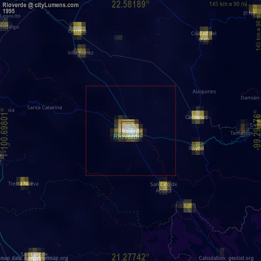
» NASA, Earths city lights 1995
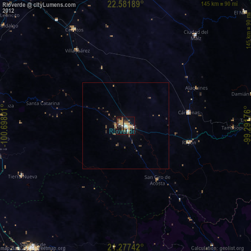
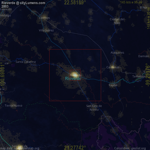
» NASA city lights 2003
» Earth at Night: Flat Maps 2012, 2016