Benemérito de las Américas night lights from space
Night Light of Benemérito de las Américas (Chiapas) from space (Mexico) Src. Average luminocity for 10x10km area is 1.9979% and for 50x50km: 0.1027%.
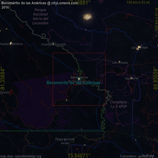
Analysis of Benemérito de las Américas night lights 2016
Square area 10x10 km:
 0%
0%90-99
0%80-89
0%70-79
0%60-69
1.65%50-59
0.83%40-49
0.83%30-39
0%20-29
0%10-19
0.41%0-9
96.28%Square area 50x50 km:
0%90-99
0%80-89
0%70-79
0%60-69
0.07%50-59
0.07%40-49
0.03%30-39
0%20-29
0%10-19
0.02%0-9
99.82%Clear (daylight) street map image can be seen on geolist.org.
Map coordinates:
17° 11' 20.1" North, 91° 21' 24.6" West
16° 30' 57.6" North, 90° 39' 13.4" West
15° 50' 26.6" North, 89° 57' 2.1" West
Some cities around Benemérito de las Américas sort by population:
• San Benito, GT
90 km =55.9 mi,  60°
60°
• Flores, GT
92.2 km =57.3 mi, 60°
• Chisec, GT
87.2 km =54.2 mi,  153°
153°
• Nueva Palestina
72.7 km =45.2 mi,  297°
297°
• Santa Ana, GT
92.9 km =57.7 mi,  70°
70°
• Sayaxché, GT
49.7 km =30.9 mi,  88°
88°
• La Libertad, GT
64.7 km =40.2 mi, 62°
• Frontera Corozal
41.3 km =25.7 mi,  323°
323°
3816362 (p: 7,259)
Sources (retrieved 2019-11-25):
» Earth at Night: Flat Maps 2012, 2016