Sayaxché night lights from space
Night Light of Sayaxché (Petén) from space (Guatemala) Src. Average luminocity for 10x10km area is 1.0826% and for 50x50km: 0.0855%.
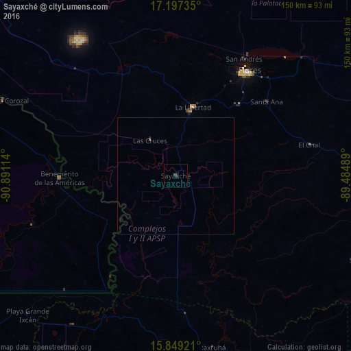
Analysis of Sayaxché night lights 2016
Square area 10x10 km:
 0%
0%90-99
0%80-89
0%70-79
0%60-69
0%50-59
0%40-49
1.03%30-39
1.45%20-29
0%10-19
0%0-9
97.52%Square area 50x50 km:
0%90-99
0%80-89
0%70-79
0.03%60-69
0%50-59
0%40-49
0.04%30-39
0.06%20-29
0.03%10-19
0%0-9
99.83%Clear (daylight) street map image can be seen on geolist.org.
Map coordinates:
17° 11' 50.5" North, 90° 53' 28.1" West
16° 31' 28.1" North, 90° 11' 16.8" West
15° 50' 57.2" North, 89° 29' 5.6" West
Some cities around Sayaxché sort by population:
• San Benito
52.2 km =32.4 mi,  33°
33°
• Flores
53.9 km =33.5 mi, 34°
• Chisec
79.4 km =49.3 mi,  187°
187°
• Santa Ana
48.6 km =30.2 mi,  50°
50°
• La Libertad
30.3 km =18.8 mi,  14°
14°
• Benemérito de las Américas, MX
49.7 km =30.9 mi,  268°
268°
• San Andrés
57 km =35.4 mi, 30°
• Frontera Corozal, MX
80.8 km =50.2 mi,  293°
293°
3588984 (p: 9,100)
Sources (retrieved 2019-11-25):
» Earth at Night: Flat Maps 2012, 2016