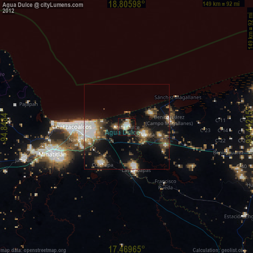
Agua Dulce night lights from space
Night Light of Agua Dulce (Veracruz) from space (Mexico) Src. Average luminocity for 10x10km area is 72.7273% and for 50x50km: 26.154%.

Analysis of Agua Dulce night lights 2016
Square area 10x10 km:
 6.49%
6.49%90-99
20.56%80-89
21%70-79
11.47%60-69
16.67%50-59
8.66%40-49
5.84%30-39
2.6%20-29
5.84%10-19
0.87%0-9
0%Square area 50x50 km:
1.88%90-99
5.87%80-89
4.43%70-79
2.99%60-69
3.8%50-59
4.68%40-49
4.89%30-39
5.07%20-29
6.48%10-19
9.89%0-9
50.02%Clear (daylight) street map image can be seen on geolist.org.
Map coordinates:
18° 48' 21.5" North, 94° 50' 54.2" West
18° 8' 20.7" North, 94° 8' 43" West
17° 28' 10.7" North, 93° 26' 31.7" West
Some cities around Agua Dulce sort by population:
• Coatzacoalcos
31.7 km =19.7 mi,  272°
272°
• Las Choapas
25.8 km =16 mi,  168°
168°
• Nanchital de Lázaro Cárdenas del Río
28.7 km =17.8 mi,  254°
254°
• Allende
26.2 km =16.3 mi, 273°
• Ixhuatlán del Sureste
28.9 km =18 mi,  243°
243°
• Villa la Venta
11.4 km =7.1 mi,  113°
113°
• Mundo Nuevo
26.5 km =16.5 mi,  257°
257°
• Cuichapa
26.4 km =16.4 mi,  212°
212°
3533269 (p: 36,079)
Sources (retrieved 2019-11-25):
» Earth at Night: Flat Maps 2012, 2016