Coatzacoalcos night lights from space
Night Light of Coatzacoalcos (Veracruz) from space (Mexico) Src. Average luminocity for 10x10km area is 70.0714% and for 50x50km: 30.8248%.
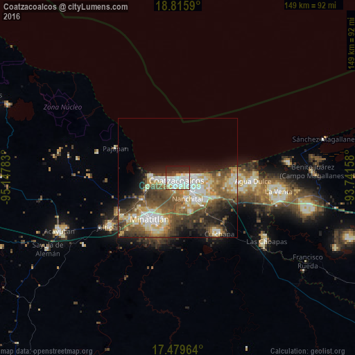
Analysis of Coatzacoalcos night lights 2016
Square area 10x10 km:
 24.89%
90-99
27.06%80-89
6.71%70-79
2.38%60-69
1.3%50-59
0.22%40-49
8.01%30-39
4.33%20-29
16.45%10-19
8.66%0-9
0%Square area 50x50 km:
3.76%90-99
7.08%80-89
5.01%70-79
3.52%60-69
3.93%50-59
5.75%40-49
6.64%30-39
5.44%20-29
6.11%10-19
7.21%0-9
45.55%Clear (daylight) street map image can be seen on geolist.org.
Map coordinates:
18° 48' 57.2" North, 95° 8' 52.2" West
18° 8' 56.6" North, 94° 26' 40.9" West
17° 28' 46.7" North, 93° 44' 29.7" West
Some cities around Coatzacoalcos sort by population:
• Minatitlán
20.4 km =12.7 mi,  215°
215°
• Nanchital de Lázaro Cárdenas del Río
9.5 km =5.9 mi,  155°
155°
• Allende
5.5 km =3.4 mi,  82°
82°
• Fraccionamiento Ciudad Olmeca
11.4 km =7.1 mi,  270°
270°
• Ixhuatlán del Sureste
15.4 km =9.6 mi, 157°
• Lomas de Barrillas
8.6 km =5.3 mi, 269°
• Mundo Nuevo
8.9 km =5.5 mi,  139°
139°
• El Naranjito
24 km =14.9 mi,  225°
225°
3530517 (p: 235,983)
Sources (retrieved 2019-11-25):
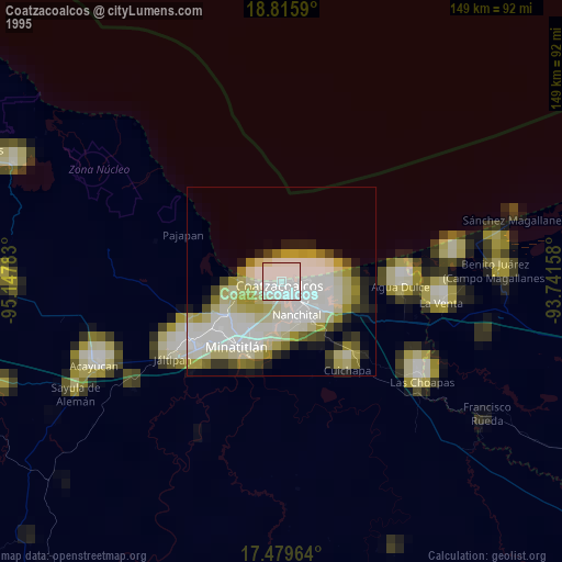
» NASA, Earths city lights 1995
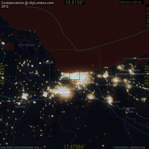
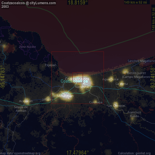
» NASA city lights 2003
» Earth at Night: Flat Maps 2012, 2016