Abasolo night lights from space
Night Light of Abasolo (Guanajuato) from space (Mexico) Src. Average luminocity for 10x10km area is 31.7292% and for 50x50km: 17.5532%.
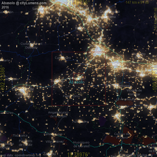
Analysis of Abasolo night lights 2016
Square area 10x10 km:
 0.57%
0.57%90-99
2.08%80-89
7.2%70-79
2.65%60-69
7.2%50-59
3.79%40-49
7.2%30-39
6.25%20-29
10.23%10-19
46.59%0-9
6.25%Square area 50x50 km:
0.8%90-99
1.08%80-89
3.07%70-79
2.47%60-69
2.25%50-59
2.16%40-49
4.87%30-39
4.2%20-29
5.25%10-19
13.19%0-9
60.66%Clear (daylight) street map image can be seen on geolist.org.
Map coordinates:
21° 6' 26.5" North, 102° 14' 1.9" West
20° 26' 59.9" North, 101° 31' 50.6" West
19° 47' 23.1" North, 100° 49' 39.4" West
Some cities around Abasolo sort by population:
• Irapuato
31.1 km =19.3 mi,  35°
35°
• Pénjamo
20.1 km =12.5 mi,  264°
264°
• Cuerámaro
24.5 km =15.2 mi,  322°
322°
• Arandas
34.7 km =21.6 mi,  28°
28°
• Pastor Ortíz
17.4 km =10.8 mi,  202°
202°
• San Roque
25.8 km =16 mi,  49°
49°
• Huanímaro
9.7 km =6 mi,  159°
159°
• Villas de Irapuato
29.4 km =18.3 mi, 26°
4019869 (p: 27,389)
Sources (retrieved 2019-11-25):
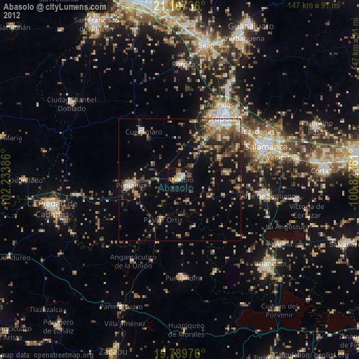
» Earth at Night: Flat Maps 2012, 2016