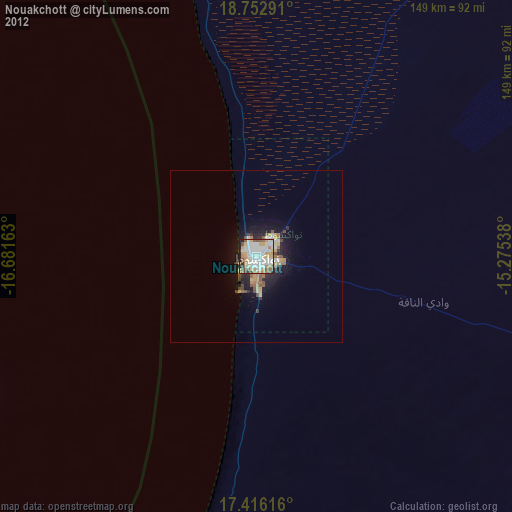
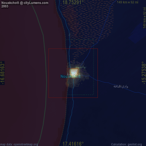
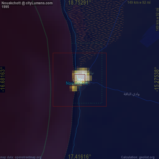
Nouakchott night lights from space
Night Light of Nouakchott from space (Mauritania) Src. Average luminocity for 10x10km area is 83.5758% and for 50x50km: 7.6999%.
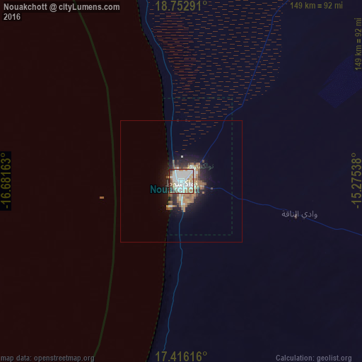
Analysis of Nouakchott night lights 2016
Square area 10x10 km:
 26.62%
90-99
35.28%80-89
8.01%70-79
3.03%60-69
10.39%50-59
6.28%40-49
3.03%30-39
2.6%20-29
4.55%10-19
0.22%0-9
0%Square area 50x50 km:
1.3%90-99
1.8%80-89
0.57%70-79
0.56%60-69
1.41%50-59
1.41%40-49
0.92%30-39
0.62%20-29
1.87%10-19
4.41%0-9
85.13%Clear (daylight) street map image can be seen on geolist.org.
Map coordinates:
18° 45' 10.5" North, 16° 40' 53.9" West
18° 5' 8.9" North, 15° 58' 42.6" West
17° 24' 58.2" North, 15° 16' 31.4" West
Some cities around Nouakchott sort by population:
• Rosso
175.8 km =109.2 mi,  173°
173°
• Richard-Toll, SN
182.9 km =113.6 mi, 170°
• Tékane
178 km =110.6 mi,  157°
157°
• Ndioum, SN
224.9 km =139.7 mi,  141°
141°
• Rosso, SN
186.2 km =115.7 mi, 174°
• Dar Naim
6 km =3.7 mi,  65°
65°
• Arafat
4.4 km =2.7 mi, 171°
• Tevragh Zeina
1.8 km =1.1 mi,  324°
324°
2377450 (p: 661,400)
Sources (retrieved 2019-11-25):
» NASA, Earths city lights 1995
» NASA city lights 2003
» Earth at Night: Flat Maps 2012, 2016