Rivière-Pilote night lights from space
Night Light of Rivière-Pilote (Martinique) from space (Martinique) Src. Average luminocity for 10x10km area is 45.5844% and for 50x50km: 16.4947%.
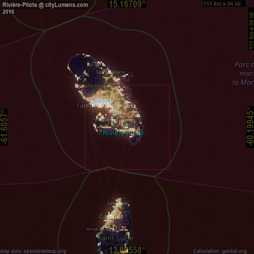
Analysis of Rivière-Pilote night lights 2016
Square area 10x10 km:
 2.6%
2.6%90-99
1.73%80-89
6.06%70-79
10.82%60-69
4.98%50-59
8.44%40-49
16.23%30-39
22.08%20-29
14.07%10-19
12.99%0-9
0%Square area 50x50 km:
1.43%90-99
1.59%80-89
3.52%70-79
3.4%60-69
2.07%50-59
2.35%40-49
3.41%30-39
3.56%20-29
4.63%10-19
7.03%0-9
67.01%Clear (daylight) street map image can be seen on geolist.org.
Map coordinates:
15° 10' 1.5" North, 61° 36' 20.5" West
14° 29' 14.6" North, 60° 54' 9.3" West
13° 48' 20.1" North, 60° 11' 58" West
Some cities around Rivière-Pilote sort by population:
• Le Lamentin
17.5 km =10.9 mi,  323°
323°
• Le François
14.2 km =8.8 mi,  359°
359°
• Ducos
12.5 km =7.8 mi, 321°
• Sainte-Luce
2.9 km =1.8 mi,  223°
223°
• Saint-Esprit
7.7 km =4.8 mi,  334°
334°
• Le Marin
3.9 km =2.4 mi,  116°
116°
• Le Vauclin
9.5 km =5.9 mi,  46°
46°
• Les Trois-Îlets
15.2 km =9.4 mi,  292°
292°
3569970 (p: 13,359)
Sources (retrieved 2019-11-25):
» Earth at Night: Flat Maps 2012, 2016